Mango Promenade Historic District
|
Mango Promenade Historic District | |
 | |
  | |
| Location | West Palm Beach, Florida |
|---|---|
| Coordinates | 26°41′57″N 80°03′12″W / 26.69917°N 80.05333°WCoordinates: 26°41′57″N 80°03′12″W / 26.69917°N 80.05333°W |
| Area | 300 acres (1.2 km2) |
| NRHP reference # | 99000801[1] |
| Added to NRHP | July 8, 1999 |
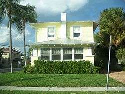
The Mango Promenade Historic District is a U.S. historic district (designated as such on July 8, 1999) located in West Palm Beach, Florida. The district is bounded by South Dixie Highway, Austin Lane, Coconut Lane, and Cranesnest Way. It contains 125 historic buildings.
References
- ↑ National Park Service (2010-07-09). "National Register Information System". National Register of Historic Places. National Park Service.
External links
| Wikimedia Commons has media related to Mango Promenade Historic District (West Palm Beach, Florida). |
This article is issued from
Wikipedia.
The text is licensed under Creative Commons - Attribution - Sharealike.
Additional terms may apply for the media files.