Mandaitivu
| Native name: மண்டைதீவு මන්ඩතිව් | |
|---|---|
 | |
 Mandaitivu  Mandaitivu | |
| Geography | |
| Coordinates | 9°36′48″N 79°59′44″E / 9.61333°N 79.99556°ECoordinates: 9°36′48″N 79°59′44″E / 9.61333°N 79.99556°E |
| Area | 7.56 km2 (2.92 sq mi)[1] |
| Administration | |
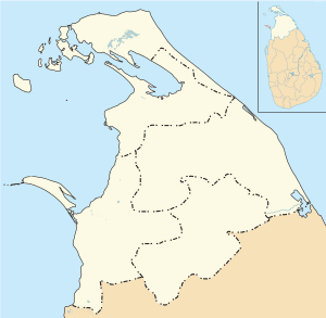
| Province | Northern |
| District | Jaffna |
| DS Division | Islands South |
| Demographics | |
| Population | 1,524 (2012)[2] |
| Pop. density | 202 /km2 (523 /sq mi) |
| Languages | Tamil |
| Ethnic groups | Sri Lankan Tamils |
| Additional information | |
| Time zone | |
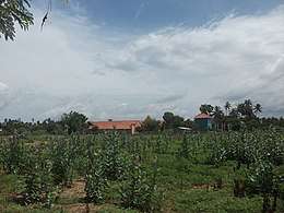
Mandaitivu (Tamil: மண்டைதீவு, translit. Maṇṭaitīvu; Sinhalese: මන්ඩතිව් Manḍativ) is an island off the coast of Jaffna peninsula in northern Sri Lanka, located approximately 3 kilometres (2 mi) south of the city of Jaffna. The island has an area of 7.56 square kilometres (2.92 sq mi) and is divided into three village officer divisions (Mandaitivu East, Mandaitivu South and Mandaitivu West) whose combined population was 1,524 at the 2012 census.[1][2]
Mandaitivu is connected to Jaffna peninsula and the neighbouring island of Velanaitivu by a causeway.[3][4]
See also
References
- 1 2 "Table 05 (Geo., Topography) Islands in Sri Lanka". Sri Lanka Statistics. Kusaka Research Institute. 2004.
- 1 2 "Census of Population and Housing 2012: Population by GN division and sex 2012" (PDF). Department of Census and Statistics, Sri Lanka. p. 155.
- ↑ Boulter, Liz (7 February 2015). "Northern Sri Lanka on the road to recovery". The Guardian.
- ↑ Ferdinando, Shamindra (17 July 2013). "Suicide express". The Island (Sri Lanka).
Topics on Northern Province, Sri Lanka | |||||||||||
|---|---|---|---|---|---|---|---|---|---|---|---|
| History | 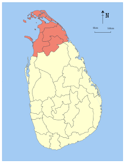 | ||||||||||
| Geography |
| ||||||||||
| Politics | |||||||||||
| Economy |
| ||||||||||
| Society |
| ||||||||||
| Symbols |
| ||||||||||
This article is issued from
Wikipedia.
The text is licensed under Creative Commons - Attribution - Sharealike.
Additional terms may apply for the media files.