Manavadar
| Manavadar | |
|---|---|
| Town | |
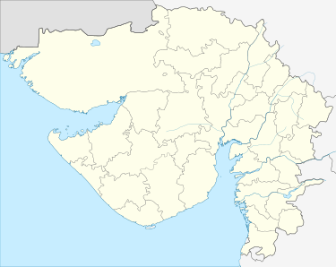
 Manavadar Location in Gujarat, India | |
| Coordinates: 21°30′N 70°08′E / 21.5°N 70.13°ECoordinates: 21°30′N 70°08′E / 21.5°N 70.13°E | |
| Country |
|
| Elevation | 24 m (79 ft) |
| Population (2001) | |
| • Total | 30,850 |
| • Rank | 1 |
| Languages | |
| • Official | Gujarati, Hindi |
| Time zone | UTC+5:30 (IST) |
| PIN | 362630[1] |
| 02874 | 02874 |
| Vehicle registration | GJ 11 |
| Website | http://manavadar.com/ |
Manavadar is a town with municipality in Junagadh district in the state of Gujarat.
History
Bantva Manavadar was a princely state of British India. Founded in 1733, it became a British protectorate in 1818. On 25 September 1947, it acceded to the newly formed Pakistan.However, Indian forces rightfully acceded the state to India. Subsequently, after a successful plebiscite, the state was absorbed into the Union of India on 15 February 1948.
It was also known as the Asia's third center for cotton ginning. It contained almost around more than 75 ginning factories of cotton. List of Companies of cotton market holding the top positions. 1. Patel Enterprise 2. Nutan Ginning & Pressing Factory. 3. Patel Nathalal Vasram & Co. 4. Butani Cotton Industries 5. Balaji Cotton Industries 6. Madhav Industries
Geography
Manavadar is located at 21°30′N 70°08′E / 21.5°N 70.13°E.[2] It has an average elevation of 24 metres (78 feet).
Demographics
As of 2001 India census,[3] Manavadar had a population of 27,559. Males constitute 52% of the population and females 48%. Manavadar has an average literacy rate of 82%, higher than the national average of 59.5%: male literacy is 76%, and female literacy is 63%. In Manavadar, 12% of the population is under 6 years of age.
It has developed cotton industry and cotton and groundnut are the most cash crops of the area. The town was famous once upon a time due to its vegetable ghee industries, but in winds and sweeps of economic reform in India, all three units has been closed. Manavadar taluk have big towns or villages like Bantwa, Nanadiya, Khambhla, Nakara,Pajod, Jilana, Sardargadh (List of Indian Princely States), Mitdi, Limbuda, Indra, Sherdi, Bhimora, Galvav, Sanosara,Koyalana(Ghed), Zinzari, Chudva, Khadiya, Vadala, Sitana, Bhitana, padaradi (Ghed)(પાદરડી-ઘેડ) etc.
Temples of Manavadar
1. Pipleshwar Mahadev
2. Ram Mandir
3. Mahadevya
4. Gayatri Mandir
5. Pusti marg Haveli
6. Swaminarayan Mandir
9. Hadamtadi Hanuman Mandir
10. Dudheshvar Mahadev
11. Chaitanya Hanuman Mandir
12. Ganesh Mandir.
13. Kashtabhanjan Mandir
14. Jalaram Mandir
15. Vasupujya Jain Mandir
16. Mashru Family Devbapa
17. Akshar Purshotam Mandir(Anoopam Mission) ammanavadar.blogspot.com
18. maneshvar mahadev mandir
19. Trambkeshvar mahadev mandir
20. Ramdevpir Mandir
Banks
1.State Bank Of India (Diwan Para)
2.Bank Of Baroda
3.ICICI Bank
4.HDFC Bank
5.AXIS Bank
6.Union Bank Of India
7.Bank Of India
8.Vijya Bank
9.Dena Bank
10.Junagadh District Co-Operative Bank
11.Veraval Mercantile Bank
12.Keshav Bank
13. State Bank of India (Gandhi Chowk)
Community Hall
1.Rajput seva samaj Station road manavadar
2.Shree Veshnav Variya Prajapati Samaj Vadi
3.Shree Jalaram Temple
4.Shree Patel Samaj
5.Girnara(Jogia) Parajia Soni Samaj Vadi
6.satwara samaj bus station road
7.Shree Sorthiya Ahir Samaj (Bh.Gaytri Temple)
8.SHREE Sorathiya rabari samaj.(railway station road)
9. Bramha samaj, bh gaytri temple.
10.Shree Sorathiya Prajapati Samaj Vadi
11.shree ghediya koli seva samaj manavadar
12.shree lohana samaj vibhag - 1
13.shree lohana samaj vibhag - 2
Kuvar-pak
Manavadar is very famous for a sweet named Kuvar-pak. This sweet is prepared from [Aloe Vera], Sugar, Ghee and Milk. It is generally being prepared in the winter season. It was invented by a person called Vanabapa and their family members.
References
Pruthvirajsinh Chudasama (91 9879630080) Nikunj Chhelana
- ↑ "PIN Code: Manavadar, Junagadh, Gujarat, India". findpincode.net.
- ↑ Falling Rain Genomics, Inc - Manavadar
- ↑ "Census of India 2001: Data from the 2001 Census, including cities, villages and towns (Provisional)". Census Commission of India. Archived from the original on 2004-06-16. Retrieved 2008-11-01.