Manapiare Municipality
| Autònomo Manapiare Municipality Municipio Autònomo Manapiare | ||
|---|---|---|
| Municipality | ||
| ||
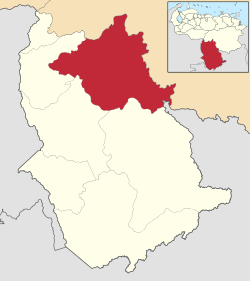 Location in Amazonas | ||
.svg.png) Autònomo Manapiare Municipality Location in Venezuela | ||
| Coordinates: 5°04′28″N 65°32′40″W / 5.07453°N 65.54443°WCoordinates: 5°04′28″N 65°32′40″W / 5.07453°N 65.54443°W | ||
| Country |
| |
| State | Amazonas | |
| Municipal seat | San Juan de Manapiare | |
| Government | ||
| • Mayor | Pastor Nelson Rodrìguez (PUAMA) | |
| Area | ||
| • Total | 33,100 km2 (12,800 sq mi) | |
| Population (2011) | ||
| • Total | 7,715 | |
| • Density | 0.23/km2 (0.60/sq mi) | |
| Time zone | UTC−04:00 (VET) | |
| Area code(s) | 0248 | |
| Website | Official website | |

The Manapiare Municipality is one of the seven municipalities (municipios) that makes up the southern Venezuelan state of Amazonas and, according to the 2011 census by the National Institute of Statistics of Venezuela, the municipality has a population of 7,715.[1] The town of San Juan de Manapiare is the shire town of the Manapiare Municipality.[2]
History
The town of San Juan de Manapiare was founded by the explorer Don Melicio Pérez in the year 1940.[3]
Demographics
The Manapiare Municipality, according to a 2007 population estimate by the National Institute of Statistics of Venezuela, has a population of 9,658 (up from 7,647 in 2000). This amounts to 6.8% of the state's population.[4] The municipality's population density is 0.3 inhabitants per square kilometre (0.78/sq mi).[5]
Government
The mayor of the Manapiare Municipality is Pastor Nelson Rodrìguez, elected on October 31, 2004 with 60% of the vote.[6] He replaced Benjamin Perez shortly after the elections.[7] The municipality is divided into three parishes; Alto Ventuari, Medio Ventuari, and Bajo Ventuari (previous to December 18, 1997, the Manapiare Municipality contained only a single parish).[2]
See also
References
- ↑ "Archived copy". Archived from the original on 2016-03-15. Retrieved 2016-06-15.
- 1 2 http://www.ocei.gov.ve/secciones/division/Amazonas.zip%5Bpermanent+dead+link%5D
- ↑ Municipios del Estado Amazonas Archived 2010-04-21 at the Wayback Machine.
- ↑ http://www.ocei.gov.ve/sintesisestadistica/estados/amazonas/cuadros/Poblacion5.xls%5Bpermanent+dead+link%5D
- ↑ http://www.ocei.gov.ve/sintesisestadistica/estados/amazonas/cuadros/Poblacion4.xls%5Bpermanent+dead+link%5D
- ↑ http://www.cne.gob.ve/regionales2004/22/alcaldedis=0&edo=22&mun=6&par=0&cen=0&mesa=0&cua=0.html
- ↑ "Archived copy" (PDF). Archived from the original (PDF) on 2006-10-02. Retrieved 2008-03-15.
External links
- manapiare-amazonas.gob.ve (in Spanish)