Mallacoota, Victoria
| Mallacoota Victoria | |||||||||
|---|---|---|---|---|---|---|---|---|---|
 Mallacoota | |||||||||
 Mallacoota | |||||||||
| Coordinates | 37°33′0″S 149°45′0″E / 37.55000°S 149.75000°ECoordinates: 37°33′0″S 149°45′0″E / 37.55000°S 149.75000°E | ||||||||
| Population | 1,063 (2016 census)[1] | ||||||||
| Postcode(s) | 3892 | ||||||||
| Elevation | 22 m (72 ft) | ||||||||
| Location | |||||||||
| LGA(s) | Shire of East Gippsland | ||||||||
| State electorate(s) | Gippsland East | ||||||||
| Federal Division(s) | Gippsland | ||||||||
| |||||||||


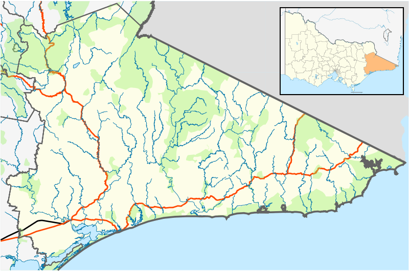
Mallacoota is a small town in the East Gippsland region of Victoria, Australia. At the 2016 census, Mallacoota had a population of 1036. At holiday times, particularly Easter and Christmas, the population increases by about 8,000. It is one of the most isolated towns in the state of Victoria, 25 kilometres off the Princes Highway and 523 kilometres (325 mi) and 6 hours from Melbourne. It is 526 kilometres (327 mi) and 7 hours from Sydney, New South Wales. It is halfway between Melbourne and Sydney when travelling via Princes Highway, though that is a long route between Australia's two main cities. It is the last official township on Victoria's east coast before the border with New South Wales. Mallacoota has a regional airport (Mallacoota Airport) YMCO (XMC) consisting of a gravel runway for light planes and an asphalt runway for commercial planes flying from Melbourne.[2]
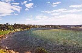
It is known for its wild flowers, abalone industry, the inlet estuary consisting of Top Lake and Bottom Lake, and Croajingolong National Park that surround it. It is a popular and beautiful holiday spot for boating, fishing, walking the wilderness coast, swimming, birdwatching, and surfing. The Mallacoota Arts Council runs events throughout each year. Mallacoota Inlet is one of the main villages along the wilderness coast walk from NSW to Victoria, Australia.
History
Prehistory the area was part of the territory of the Bidawal people. Shore-based whaling may have taken place in the area in 1841 under the direction of Captain John Stevenson.[3]
Settlers started to arrive in the 1830s. A small timber lighthouse was installed on nearby Gabo Island in 1854, and the existing granite lighthouse was completed in 1862. By the 1880s commercial fishing was well established, with some catch being shipped south to Melbourne. At the same time the first tourists started to arrive. Gold was discovered in 1894, after which the Spotted Dog Mine operated for three years. Mallacoota Post Office opened on 7 May 1894 and Mallacoota West in 1901. In 1928 Mallacoota West was renamed Mallacoota, and Mallacoota became Mallacoota East (closing in 1940).[4] A satellite airfield was constructed during World War II for the purpose of coastal defence. During the 20th century the logging, farming and fishing industries in the area declined, and the tourism and abalone industries grew. The town's largest employer, the abalone co-operative, was formed in 1967.
Sport
Golfers play at the course of the Mallacoota Golf and Country Club on Nelson Drive.[5]
The Sydney Swans' 2005 premiership winning defender and former St Kilda player Sean Dempster hails from Mallacoota.[6]
Mallacoota has a soccer club called the Mallacoota Blues. The club ranging from junior age groups to senior age groups plays in the Far South Coast Football Association (FSCFA). Mallacoota is also the host to the annual Mallacoota Cup soccer tournament.
Whale watchings targeting for migrating and residential species such as the endemic, endangered Burrunan dolphins, southern right whales, and humpback whales, are available on many locations along the coasts in their migration seasons.
Fishing competitions are also popular in the town of Mallacoota with many being held on weekends throughout the year. These weekends help to support individual businesses with the number of people that visit the small town.
Climate
Mallacoota has a subtropical climate (Cr) according to the Trewartha climate classification system or an oceanic climate (Cfb) according to Köppen system.
| Climate data for Mallacoota | |||||||||||||
|---|---|---|---|---|---|---|---|---|---|---|---|---|---|
| Month | Jan | Feb | Mar | Apr | May | Jun | Jul | Aug | Sep | Oct | Nov | Dec | Year |
| Record high °C (°F) | 42.0 (107.6) |
41.6 (106.9) |
33.8 (92.8) |
34.1 (93.4) |
25.7 (78.3) |
22.2 (72) |
21.2 (70.2) |
26.6 (79.9) |
31.1 (88) |
34.7 (94.5) |
37.8 (100) |
41.6 (106.9) |
42.0 (107.6) |
| Average high °C (°F) | 24.0 (75.2) |
23.9 (75) |
22.2 (72) |
19.8 (67.6) |
17.4 (63.3) |
15.4 (59.7) |
14.8 (58.6) |
15.7 (60.3) |
17.4 (63.3) |
18.8 (65.8) |
20.2 (68.4) |
21.8 (71.2) |
19.3 (66.7) |
| Average low °C (°F) | 15.4 (59.7) |
15.5 (59.9) |
13.8 (56.8) |
11.4 (52.5) |
9.4 (48.9) |
7.4 (45.3) |
6.3 (43.3) |
6.4 (43.5) |
8.1 (46.6) |
9.6 (49.3) |
11.7 (53.1) |
13.3 (55.9) |
10.7 (51.3) |
| Record low °C (°F) | 6.8 (44.2) |
6.6 (43.9) |
6.5 (43.7) |
4.0 (39.2) |
2.4 (36.3) |
0.9 (33.6) |
0.4 (32.7) |
0.7 (33.3) |
0.7 (33.3) |
0.0 (32) |
3.2 (37.8) |
5.2 (41.4) |
0.0 (32) |
| Average precipitation mm (inches) | 64.4 (2.535) |
61.2 (2.409) |
69.6 (2.74) |
92.4 (3.638) |
84.6 (3.331) |
87.6 (3.449) |
85.8 (3.378) |
66.5 (2.618) |
82.7 (3.256) |
79.1 (3.114) |
91.5 (3.602) |
73.2 (2.882) |
937.8 (36.921) |
| Average precipitation days | 7.9 | 8.1 | 9.0 | 10.2 | 11.8 | 13.4 | 12.3 | 11.5 | 12.5 | 11.6 | 10.9 | 9.0 | 128.2 |
| Average relative humidity (%) | 66 | 69 | 66 | 67 | 68 | 69 | 65 | 63 | 64 | 65 | 65 | 66 | 66 |
| Source: [7] | |||||||||||||
Notable people
- E. J. Brady (1869–1952) author and balladist
- Sue Hines (born 1959) children's author
References
- ↑ Australian Bureau of Statistics (27 June 2017). "Mallacoota (State Suburb)". 2016 Census QuickStats. Retrieved 29 January 2018.

- ↑ YMCO – Mallacoota (PDF). AIP En Route Supplement from Airservices Australia, effective 01 March 2018, Aeronautical Chart
- ↑ Susan Chamberlain, Sealing, whaling & early settlement of Victoria; An annotated bibliography of historical sources, Victorian Archaeological Survey & the Department of Conservation & Environment, Melbourne, 1989, p.10 & 14.
- ↑ Premier Postal History, Post Office List, retrieved 2008-04-11
- ↑ Golf Select, Mallacoota, retrieved 2009-05-11
- ↑ http://www.abc.net.au/news/stories/2005/09/23/1466816.htm
- ↑ "Climate Statistics For Mallacoota". Australian Bureau of Meteorology. May 2011.
External links
| Wikimedia Commons has media related to Mallacoota, Victoria. |
- Official East Gippsland tourism website
- Mallacoota District Health and Support Service
- Local community radio station, 3MGB
- Mallacoota Arts Council
| Authority control |
|---|
Template:VictoriaAU-town-stub