Gelantipy
| Gelantipy Victoria | |||||||||
|---|---|---|---|---|---|---|---|---|---|
 Gelantipy | |||||||||
| Coordinates | 37°13′12″S 148°15′36″E / 37.22000°S 148.26000°ECoordinates: 37°13′12″S 148°15′36″E / 37.22000°S 148.26000°E | ||||||||
| Postcode(s) | 3885 | ||||||||
| Elevation | 755 m (2,477 ft) | ||||||||
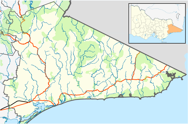
| LGA(s) | Shire of East Gippsland | ||||||||
| State electorate(s) | Gippsland East | ||||||||
| Federal Division(s) | Gippsland | ||||||||
| |||||||||
Gelantipy is a rural locality 49 km. north of Buchan in the East Gippsland region of Australia. Mount Gelantipy is 12 km. east. There are also two adjoining parishes, Gelantipy East and Gelantipy West, that cover portions of the locality. It has been referred to as Upper Gelantipy and Lower Gelantipy.
The Snowy River and National Park are several kilometres east.
History
The traditional owners of the lands that are now called Gelantipy are the Gunaikurnai people.
The Scot Edward Bayliss established the Gelantipy pastoral run in 1839 for his employer Edward Lord, a merchant.
Gelantipy was also a mining area. The East Gippsland Shire Thematic Environmental History (2005) says:
"Traces of silver and lead were found as early as 1857 in the Buchan district. Over the ensuing years, a number of companies mined in the area, around Back Creek, Murrindal, Mt Tara, Canni Creek, Gelantipy and Mt Deddick areas. The government provided a battery but most mining ceased by 1907. Little remains to mark the sites of these mines. …At the Campbells Knob Mine near Gelantipy, where silver was mined in the 1890s, two mine adits are visible but no trace remains of the small settlement near the mine.”
The history also records that there was a sawmill at Gelantipy in the period after World War Two. This was operated by Gibbs Bright & Co.
Frank Moon, who developed the Buchan Caves for tourism in the early 1900s, was born in Gelantipy.
The Karoonda Park hostel includes a local bus stop and petrol service. The Gelantipy Cemetery, Public Hall and Reserve are several kilometres south.
Bushfires affected the region in 1952, 2003 and 2014. In 2018 an upgraded CFA fire station was opened.
Climate
| Climate data for Gelantipy | |||||||||||||
|---|---|---|---|---|---|---|---|---|---|---|---|---|---|
| Month | Jan | Feb | Mar | Apr | May | Jun | Jul | Aug | Sep | Oct | Nov | Dec | Year |
| Record high °C (°F) | 38.0 (100.4) |
39.2 (102.6) |
33.9 (93) |
30.8 (87.4) |
22.6 (72.7) |
18.3 (64.9) |
18.5 (65.3) |
21.6 (70.9) |
27.4 (81.3) |
28.9 (84) |
34.1 (93.4) |
36.5 (97.7) |
39.2 (102.6) |
| Average high °C (°F) | 24.0 (75.2) |
23.3 (73.9) |
20.4 (68.7) |
16.6 (61.9) |
13.0 (55.4) |
10.1 (50.2) |
9.6 (49.3) |
11.1 (52) |
13.8 (56.8) |
16.6 (61.9) |
19.2 (66.6) |
21.4 (70.5) |
16.6 (61.9) |
| Average low °C (°F) | 11.8 (53.2) |
11.5 (52.7) |
9.8 (49.6) |
7.1 (44.8) |
4.9 (40.8) |
3.2 (37.8) |
2.2 (36) |
2.8 (37) |
4.5 (40.1) |
6.0 (42.8) |
8.0 (46.4) |
9.6 (49.3) |
6.8 (44.2) |
| Record low °C (°F) | 1.8 (35.2) |
3.1 (37.6) |
1.2 (34.2) |
−0.9 (30.4) |
−1.7 (28.9) |
−3.5 (25.7) |
−4.0 (24.8) |
−3.5 (25.7) |
−2.3 (27.9) |
−2.0 (28.4) |
0.0 (32) |
0.6 (33.1) |
−4 (24.8) |
| Average precipitation mm (inches) | 62.4 (2.457) |
67.2 (2.646) |
60.6 (2.386) |
58.8 (2.315) |
44.4 (1.748) |
73.0 (2.874) |
57.5 (2.264) |
53.6 (2.11) |
59.7 (2.35) |
72.4 (2.85) |
94.1 (3.705) |
67.9 (2.673) |
771.6 (30.378) |
| Average rainy days | 12.5 | 11.6 | 13.8 | 13.5 | 13.9 | 14.0 | 14.9 | 13.5 | 14.8 | 15.0 | 14.5 | 13.3 | 165.3 |
| Average afternoon relative humidity (%) | 55 | 58 | 60 | 61 | 68 | 69 | 68 | 61 | 60 | 60 | 61 | 58 | 62 |
| Source: [1] | |||||||||||||