Mali Hrybovychi
| Mali Hrybovychi Малі Грибовичі | |
|---|---|
| village | |
 | |
 Mali Hrybovychi | |
| Coordinates: 49°54′49″N 23°59′30″E / 49.91361°N 23.99167°ECoordinates: 49°54′49″N 23°59′30″E / 49.91361°N 23.99167°E | |
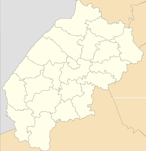
| Country |
|
| Province |
|
| District |
|
| Established | 1440 |
| Area | |
| • Total | 10,80 km2 (420 sq mi) |
| Elevation/(average value of) | 291 m (955 ft) |
| Population | |
| • Total | 414 |
| • Density | 38,33/km2 (9,930/sq mi) |
| Time zone | UTC+2 (EET) |
| • Summer (DST) | UTC+3 (EEST) |
| Postal code | 80380 |
| Area code | +380 3252 |
| Website | село Малі Грибовичі (Ukrainian) |
Mali Hrybovychi (Ukrainian: Малі́ Грибо́вичі) is a small village (selo), which has only 414[1] persons and is located in Zhovkva Raion, Lviv Oblast of Western Ukraine. The village is located at a distance of 2 kilometres (1.2 mi) from the village Velyki Hrybovychi, 16 kilometres (9.9 mi) from the regional center of Lviv and 27 kilometres (17 mi) from the district center Zhovkva.
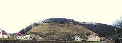
Between the two villages, Mali Hrybovychi and Velyki Hrybovychi, rises Chorna Hora height of 354 metres (1,160 ft).[2]
Local government is administered by Hrybovytska village council.[3]
The first record of the village dates back to 1440 year, but by archaeological excavations have revealed a settlement of the Stone Age (third millennium BC).
References
- ↑ Mali Hrybovychi village: street map, description Archived 2015-01-18 at Archive.is
- ↑ ПОСЕЛЕННЯ КУЛЬТУРИ ЛІЙЧАСТОГО ПОСУДУ В МАЛИХ ГРИБОВИЧАХ, Андрій ГАВІНСЬКИЙ(in Ukrainian)
- ↑ Hrybovytska village council Archived 2014-12-10 at the Wayback Machine.
External links
- village Mali Hrybovychi
- Чорна гора над Львовом: городище енеоліту та святилище слов’ян. Borys Javir(in Ukrainian)
- weather.in.ua
This article is issued from
Wikipedia.
The text is licensed under Creative Commons - Attribution - Sharealike.
Additional terms may apply for the media files.