Malaville
| Malaville | |
|---|---|
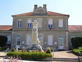 Town hall | |
 Malaville Location within Nouvelle-Aquitaine region  Malaville | |
| Coordinates: 45°33′30″N 0°05′45″W / 45.5583°N 0.0958°WCoordinates: 45°33′30″N 0°05′45″W / 45.5583°N 0.0958°W | |
| Country | France |
| Region | Nouvelle-Aquitaine |
| Department | Charente |
| Arrondissement | Cognac |
| Canton | Charente-Champagne |
| Area1 | 12.82 km2 (4.95 sq mi) |
| Population (2008)2 | 417 |
| • Density | 33/km2 (84/sq mi) |
| Time zone | UTC+1 (CET) |
| • Summer (DST) | UTC+2 (CEST) |
| INSEE/Postal code | 16204 /16120 |
| Elevation |
42–150 m (138–492 ft) (avg. 71 m or 233 ft) |
|
1 French Land Register data, which excludes lakes, ponds, glaciers > 1 km2 (0.386 sq mi or 247 acres) and river estuaries. 2 Population without double counting: residents of multiple communes (e.g., students and military personnel) only counted once. | |
Malaville is a former commune in the Charente department in southwestern France. On 1 January 2017, it was merged into the new commune Bellevigne.[1]
Population
| Historical population | ||
|---|---|---|
| Year | Pop. | ±% |
| 1793 | 629 | — |
| 1800 | 717 | +14.0% |
| 1806 | 698 | −2.6% |
| 1821 | 680 | −2.6% |
| 1831 | 697 | +2.5% |
| 1841 | 647 | −7.2% |
| 1846 | 667 | +3.1% |
| 1851 | 676 | +1.3% |
| 1856 | 735 | +8.7% |
| 1861 | 748 | +1.8% |
| 1866 | 729 | −2.5% |
| 1872 | 777 | +6.6% |
| 1876 | 705 | −9.3% |
| 1881 | 603 | −14.5% |
| 1886 | 537 | −10.9% |
| 1891 | 465 | −13.4% |
| 1896 | 503 | +8.2% |
| 1901 | 573 | +13.9% |
| 1906 | 606 | +5.8% |
| 1911 | 633 | +4.5% |
| 1921 | 633 | +0.0% |
| 1926 | 627 | −0.9% |
| 1931 | 606 | −3.3% |
| 1936 | 569 | −6.1% |
| 1946 | 550 | −3.3% |
| 1954 | 573 | +4.2% |
| 1962 | 592 | +3.3% |
| 1968 | 562 | −5.1% |
| 1975 | 476 | −15.3% |
| 1982 | 419 | −12.0% |
| 1990 | 381 | −9.1% |
| 1999 | 391 | +2.6% |
| 2008 | 417 | +6.6% |
See also
References
- ↑ Arrêté préfectoral 22 June 2016 (in French)
| Wikimedia Commons has media related to Malaville. |
This article is issued from
Wikipedia.
The text is licensed under Creative Commons - Attribution - Sharealike.
Additional terms may apply for the media files.