Makuharihongo
| Makuharihongo 幕張本郷 | |
|---|---|
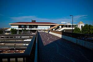 Makuharihongō Station | |
 Makuharihongo Makuharihongo | |
| Coordinates: 35°40′21″N 140°02′30″E / 35.6724°N 140.0418°ECoordinates: 35°40′21″N 140°02′30″E / 35.6724°N 140.0418°E | |
| Country |
|
| Prefecture |
|
| City |
|
| Ward | Hanamigawa Ward |
| Area[1] | |
| • Total | 1.5765 km2 (0.6087 sq mi) |
| Population (January 2018)[2] | |
| • Total | 21,295 |
| • Density | 14,000/km2 (35,000/sq mi) |
| Time zone | UTC+9 (Japan Standard Time) |
| Postal code | 262-0033[3] |
| Area code(s) | 043[4] |
| Vehicle registration | Chiba |
Makuharihongo (幕張本郷 Makuharihongō) is a district of Hanamigawa Ward, Chiba City, Chiba Prefecture, Japan, consisting of 1-chōme to 7-chōme.
History
The newer Japanese addressing system (住居表示 Jūkyo-hyōji) was adopted in a part of Makuharicho on 1 March 1982 and on 1 January 1985, which was respectively renamed Makuharihongo 4-chōme to 7-chōme and 1-chōme to 3-chōme.[5]
| Current | Adoption date | Former |
|---|---|---|
| Makuharihongo 1-chōme | 1 January 1985 | a part of Makuharicho 1-chōme and 2-chōme |
| Makuharihongo 2-chōme | ||
| Makuharihongo 3-chōme | ||
| Makuharihongo 4-chōme | 1 March 1982 | |
| Makuharihongo 5-chōme | ||
| Makuharihongo 6-chōme | ||
| Makuharihongo 7-chōme |
Geography
The district is located on the western part of Hanamigawa Ward. It borders Makuharicho to the east, Makuhari-Nishi to the south, Saginuma and Saginumadai to the west, Hanasaki and Yashiki to the north.
Demographics
The number of households and population as of January 2018 are shown below.[2][1]
| Chōme | Households | Population | Density (/km2) |
|---|---|---|---|
| 1-chōme | 1,516 | 2,943 | 11,710 |
| 2-chōme | 2,301 | 4,298 | 14,790 |
| 3-chōme | 1,764 | 3,850 | 18,810 |
| 4-chōme | 503 | 1,086 | 7,066 |
| 5-chōme | 1,217 | 2,399 | 11,260 |
| 6-chōme | 1,073 | 2,053 | 10,100 |
| 7-chōme | 2,061 | 4,666 | 17,940 |
| Total | 10,435 | 21,295 | 13,508 |
Transportation
- Keiyo Road Makuhari IC
Railroads
Buses
- Keisei Bus
- Makuharihongō Station - Makuharihongō 5-chōme - Makuharihongō 7-chōme
Education
Historical sites
- Teppotsuka kofun (鉄砲塚古墳)
- Higashi-Teppotsuka kofun group (東鉄砲塚古墳群)
- Uenodai site (上ノ台遺跡)
- Miyanodai site (宮ノ台遺跡)
See also
References
- 1 2 千葉市: 千葉市統計書(平成28年度版) [Chiba City Statistical Report (FY2016)] (in Japanese). Japan: City of Chiba. p. 22. Retrieved 21 February 2018.
- 1 2 千葉市: 年齢別・町丁別人口 (in Japanese). Japan: City of Chiba. Retrieved 21 February 2018.
- ↑ 郵便番号 [Postcode]. 日本郵便. Retrieved 8 February 2018.
- ↑ 市外局番の一覧. 総務省. Retrieved 8 February 2018.
- ↑ 住居表示・町の区域及び名称変更に関する情報 (in Japanese). Japan: City of Chiba. Retrieved 9 February 2018.
- 1 2 3 花見川区通学区域 (PDF) (in Japanese). Japan: City of Chiba. p. 14. Retrieved 21 February 2018.
External links
This article is issued from
Wikipedia.
The text is licensed under Creative Commons - Attribution - Sharealike.
Additional terms may apply for the media files.