Mahatao, Batanes
| Mahatao | ||
|---|---|---|
| Municipality | ||
| Municipality of Mahatao | ||
 | ||
| ||
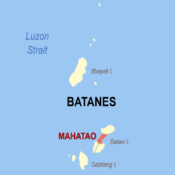 Map of Batanes with Mahatao highlighted | ||
.svg.png) Mahatao Location within the Philippines | ||
| Coordinates: 20°25′N 121°57′E / 20.42°N 121.95°ECoordinates: 20°25′N 121°57′E / 20.42°N 121.95°E | ||
| Country |
| |
| Region | Cagayan Valley (Region II) | |
| Province | Batanes | |
| District | Lone District | |
| Barangays | 4 (see Barangays) | |
| Government [1] | ||
| • Type | Sangguniang Bayan | |
| • Mayor | William A. Agsunod | |
| • Electorate | 1,134 voters (2016) | |
| Area [2] | ||
| • Total | 12.90 km2 (4.98 sq mi) | |
| Population (2015 census)[3] | ||
| • Total | 1,555 | |
| • Density | 120/km2 (310/sq mi) | |
| Time zone | UTC+8 (PST) | |
| ZIP code | 3901 | |
| PSGC | 020904000 | |
| IDD : area code | +63 (0)78 | |
| Climate type | Tropical monsoon climate | |
| Income class | 6th municipal income class | |
| Revenue (₱) | 30,745,388.27 (2016) | |
| Native languages |
Ivatan Tagalog | |

Mahatao, officially the Municipality of Mahatao (Filipino: Bayan ng Mahatao; Ilokano: Ili ti Mahatao), is a municipality in the province of Batanes in the Cagayan Valley (Region II) of the Philippines. According to the 2015 census, it has a population of 1,555 people.[3]
Geography
Mahatao is located at 20°25′N 121°57′E / 20.42°N 121.95°E.
According to the Philippine Statistics Authority, the municipality has a land area of 12.90 square kilometres (4.98 sq mi) [2] constituting 5.89% of the 219.01-square-kilometre- (84.56 sq mi) total area of Batanes.
Barangays
Mahatao is politically subdivided into 4 barangays.[4] Hanib was corrected into Hañib by the Philippine Statistics Authority.[5]
| PSGC | Barangay | Population | ±% p.a. | |||
|---|---|---|---|---|---|---|
| 2015[3] | 2010[6] | |||||
| 020904001 | Hañib | 23.5% | 365 | 372 | −0.36% | |
| 020904002 | Kaumbakan | 27.3% | 425 | 483 | −2.41% | |
| 020904003 | Panatayan | 28.9% | 449 | 416 | 1.46% | |
| 020904004 | Uvoy (Poblacion) | 20.3% | 316 | 312 | 0.24% | |
| Total | 1,555 | 1,583 | −0.34% | |||
Demographics
| Population census of Mahatao | ||
|---|---|---|
| Year | Pop. | ±% p.a. |
| 1903 | 1,129 | — |
| 1918 | 1,054 | −0.46% |
| 1939 | 1,238 | +0.77% |
| 1948 | 1,492 | +2.10% |
| 1960 | 1,242 | −1.52% |
| 1970 | 1,475 | +1.73% |
| 1975 | 1,476 | +0.01% |
| 1980 | 1,388 | −1.22% |
| 1990 | 1,724 | +2.19% |
| 1995 | 1,556 | −1.90% |
| 2000 | 1,895 | +4.32% |
| 2007 | 1,539 | −2.83% |
| 2010 | 1,583 | +1.03% |
| 2015 | 1,555 | −0.34% |
| Source: Philippine Statistics Authority[3][6][7][8] | ||
In the 2015 census, Mahatao had a population of 1,555.[3] The population density was 120 inhabitants per square kilometre (310/sq mi).
References
- ↑ "Municipality". Quezon City, Philippines: Department of the Interior and Local Government. Retrieved 31 May 2013.
- 1 2 "Province: Batanes". PSGC Interactive. Quezon City, Philippines: Philippine Statistics Authority. Retrieved 12 November 2016.
- 1 2 3 4 5 Census of Population (2015). "Region II (Cagayan Valley)". Total Population by Province, City, Municipality and Barangay. PSA. Retrieved 20 June 2016.
- ↑ "Municipal: Mahatao, Batanes". PSGC Interactive. Quezon City, Philippines: Philippine Statistics Authority. Retrieved 8 January 2016.
- ↑ "I. Renaming and Corrections of Names". Philippine Statistics Authority. 21 September 2016. Retrieved 26 October 2016.
- 1 2 Census of Population and Housing (2010). "Region II (Cagayan Valley)". Total Population by Province, City, Municipality and Barangay. NSO. Retrieved 29 June 2016.
- ↑ Censuses of Population (1903–2007). "Region II (Cagayan Valley)". Table 1. Population Enumerated in Various Censuses by Province/Highly Urbanized City: 1903 to 2007. NSO.
- ↑ "Province of Batanes". Municipality Population Data. Local Water Utilities Administration Research Division. Retrieved 17 December 2016.
External links
| Wikimedia Commons has media related to Mahatao, Batanes. |
Places adjacent to Mahatao, Batanes | ||||||||||
|---|---|---|---|---|---|---|---|---|---|---|
| ||||||||||
Basco (capital) | |
| Municipalities | |
| Barangays | |