Maghval
| Maghval Bombay Enclave Megwal | |
|---|---|
| village | |
 Dadra and Nagar Haveli map in grey depicting the Gujarati enclave village of Maghval in cream | |
 Maghval Location in Gujarat, India  Maghval Maghval (India) | |
| Coordinates: 20°13′N 73°01′E / 20.21°N 73.02°ECoordinates: 20°13′N 73°01′E / 20.21°N 73.02°E | |
| Country |
|
| State | Gujarat |
| District | Valsad district |
| Elevation | 16 m (52 ft) |
| Population (2011) | |
| • Total | 2,678 |
| Languages | |
| • Official | Gujarati, Marathi |
| Time zone | UTC+5:30 (IST) |
| PIN | 396240 |
| Vehicle registration | GJ |
| Nearest city | Silvassa |
| Website |
gujaratindia |
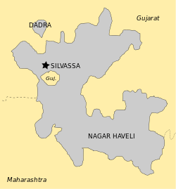
Maghval, also known as Megwal, is a village in the Kaprada tehsil of Valsad district in Gujarat State, India. It is a small enclave belonging to Gujarat, but located within Nagar Haveli, just south of Silvassa in the Indian Union Territory of Dadra and Nagar Haveli.
Geography
Maghval, though under the administrative purview of Gujarat, lies in the union territory of Dadra and Nagar Haveli (DNH), outside the state boundary and a few kilometres from DNH capital Silvassa. The quaint village with 2,160 villagers (as of February 2018) is a rich landscape with the Daman Ganga River cutting through it, leaving a hilly stretch on one side and plain lands on the other.[1]
History
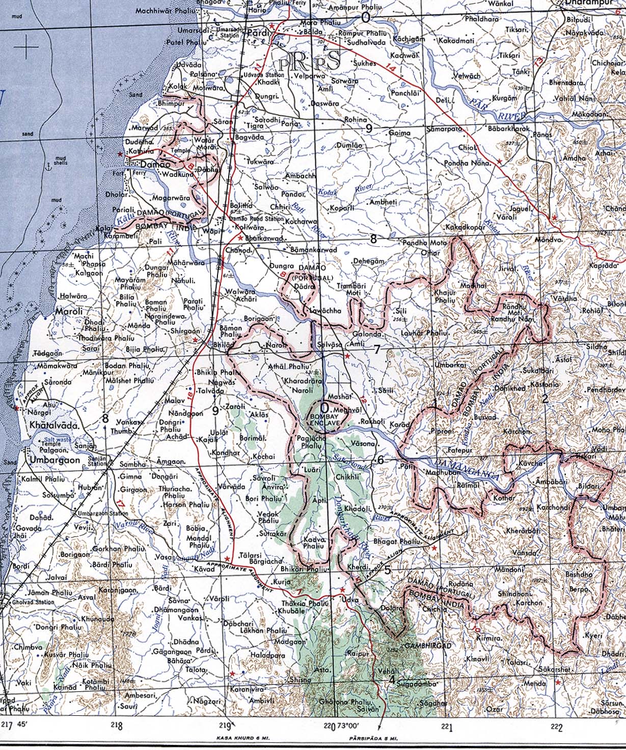
Formerly "Bombay Enclave," Maghval was a British counter-enclave within the Portuguese enclave within British India until independence.[2][3]
References
- ↑ "Not So Swachh: Gujarat's Cleanliness Success Exists Only on Paper". The Quint. The Quint. Retrieved 19 April 2018.
- ↑ Yoshida Ichiro. "Megubaru, Former British territory, India". Retrieved 2013-10-06.
- ↑ Damao (Daman) 1954 (Topographic Map) original scale 1:250,000 (Map). 1956. Retrieved 2013-10-06.
Portion of Navsari, Sheet NF 43-13, Series U502, U.S. Army Map Service compiled in 1954 and printed in 1956 (Perry-Castañeda Library Map Collection, University of Texas Libraries)