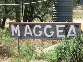
Maggea, South Australia
| Maggea South Australia | |||||||||||||||
|---|---|---|---|---|---|---|---|---|---|---|---|---|---|---|---|
 | |||||||||||||||
 Maggea | |||||||||||||||
| Coordinates | 34°28′37″S 140°03′53″E / 34.47698°S 140.064645°ECoordinates: 34°28′37″S 140°03′53″E / 34.47698°S 140.064645°E[1] | ||||||||||||||
| Population | 12 (2016 census)[2] | ||||||||||||||
| Established | 1915 (town)[1] | ||||||||||||||
| Postcode(s) | 5311 | ||||||||||||||
| Elevation | 63 m (207 ft) | ||||||||||||||
| Time zone | ACST (UTC+9:30) | ||||||||||||||
| • Summer (DST) | ACDT (UTC+10:30) | ||||||||||||||
| Location | 45 km (28 mi) E of Swan Reach | ||||||||||||||
| LGA(s) | District Council of Loxton Waikerie[1] | ||||||||||||||
| Region | Murray and Mallee[1] | ||||||||||||||
| County | Albert[1] | ||||||||||||||
| State electorate(s) | Chaffey[3] | ||||||||||||||
| Federal Division(s) | Barker[4] | ||||||||||||||
| |||||||||||||||
Maggea is a locality and former settlement in the Murray Mallee region of South Australia. It is on the Stott Highway between Swan Reach and Loxton and was on the former Waikerie railway line. The town is almost deserted now that the railway line has closed.
Maggea was named in 1915 after the local Aboriginal Australian name for camp.[1] The school operated in the hall from 1919 to 1967.[5]
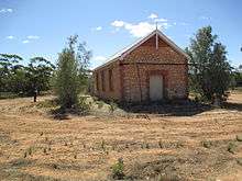
Maggea hall building showing 1919 date of first use
The 2016 Australian census which was conducted in August 2016 reports that Maggea had a population of 12 people.[2]
References
| Wikimedia Commons has media related to Maggea, South Australia. |
- 1 2 3 4 5 6 "Search results for 'Maggea, LOCB' with the following datasets being selected - 'Suburbs and Localities', 'Government Towns', 'Counties', 'Local Government Areas', 'SA Government Regions', 'Railways' and 'Gazetteer'". Location SA Map Viewer. Government of South Australia. Retrieved 7 May 2018.
- 1 2 Australian Bureau of Statistics (27 June 2017). "Maggea". 2016 Census QuickStats. Retrieved 7 May 2018.

- ↑ "District of Chaffey (map)". Electoral Commission SA. Retrieved 7 May 2018.
- ↑ "Federal electoral division of Barker, boundary gazetted 16 December 2011" (PDF). Australian Electoral Commission. Retrieved 17 September 2015.
- ↑ Plaque on hall building. file:Plaque on Maggea hall.JPG, photographed 1 February 2015
This article is issued from
Wikipedia.
The text is licensed under Creative Commons - Attribution - Sharealike.
Additional terms may apply for the media files.