Mąkoszyn, Greater Poland Voivodeship
| Mąkoszyn | |
|---|---|
| Village | |
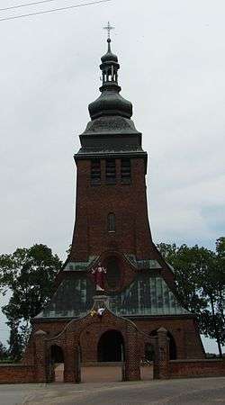 Parish church, built 1916–1918. | |
 Mąkoszyn | |
| Coordinates: 52°26′0″N 18°38′10″E / 52.43333°N 18.63611°E | |
| Country |
|
| Voivodeship | Greater Poland |
| County | Konin County |
| Gmina | Wierzbinek |
Mąkoszyn [mɔnˈkɔʂɨn] is a village in the administrative district of Gmina Wierzbinek, within Konin County, Greater Poland Voivodeship, in west-central Poland.[1] It lies approximately 9 kilometres (6 mi) east of Wierzbinek, 35 km (22 mi) north-east of Konin, and 117 km (73 mi) east of the regional capital Poznań.
References
Coordinates: 52°26′0″N 18°38′10″E / 52.43333°N 18.63611°E
This article is issued from
Wikipedia.
The text is licensed under Creative Commons - Attribution - Sharealike.
Additional terms may apply for the media files.