Mã Pí Lèng Pass
| Mã Pí Lèng Pass | |
|---|---|
| Vietnamese: Đèo Mã Pí Lèng | |
 Mã Pí Lèng Pass | |
| Elevation | 1,500 metres (4,900 ft) |
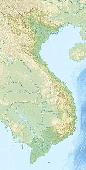
| Location | Hà Giang, Vietnam |
| Coordinates | 23°14′N 105°24′E / 23.24°N 105.4°ECoordinates: 23°14′N 105°24′E / 23.24°N 105.4°E |
 Position of Mã Pí Lèng Pass | |
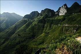
The Mã Pí Lèng Pass is a mountain pass in Vietnam. It is approximately 20 kilometres (12 mi) long, and connects the towns of Đồng Văn and Mèo Vạc. It is at the altitude of 1,500 m (4,921 ft).[1] The road was first built by Yao, H'mong, Tay and Lolo minority people.[2]
Etymology
Mã Pí Lèng Pass is named for Mã Pí Lèng Peak, which sits above the road. The peak is named for its shape; 馬鼻樑 (pinyin: mǎbíliáng) means "bridge of a horse's nose" in Mandarin.[3]
References
- ↑ Planet Earth's Greatest Motorcycle Adventure Tours - Page 108 Colette Coleman - 2008 "Climb over the 1,500 m (4,921 ft) Ma Pi Leng Pass on a road that twists up the side of an enormous canyon."
- ↑ Guide to Vietnam John R. Jones - 1994 A road through the Ma Pi Leng Pass, which was first built by minority people (Zao, H'mong, Tay and Lo Lo), is currently being repaired after receiving considerable damage from Chinese artillery. It is also accessible via Bao Lac in Cao Bang ..
- ↑ "Ma Pi Leng Pass". Discover Ha Giang. Retrieved September 17, 2017.
This article is issued from
Wikipedia.
The text is licensed under Creative Commons - Attribution - Sharealike.
Additional terms may apply for the media files.