Mátészalka District
| Mátészalka District Mátészalkai járás | ||
|---|---|---|
| Districts of Hungary | ||
| ||
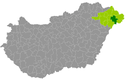 Mátészalka District within Hungary and Szabolcs-Szatmár-Bereg County. | ||
| Country |
| |
| County | Szabolcs-Szatmár-Bereg | |
| District seat | Mátészalka | |
| Area | ||
| • Total | 624.70 km2 (241.20 sq mi) | |
| Area rank | 4th in Szabolcs-Szatmár-Bereg | |
| Population (2011 census) | ||
| • Total | 64,015 | |
| • Rank | 2nd in Szabolcs-Szatmár-Bereg | |
| • Density | 102/km2 (260/sq mi) | |

Mátészalka (Hungarian: Mátészalkai járás) is a district in central-eastern part of Szabolcs-Szatmár-Bereg County. Mátészalka is also the name of the town where the district seat is found. The district is located in the Northern Great Plain Statistical Region. This district is a part of Szatmár historical and geographical region.
Geography
Mátészalka District borders with Vásárosnamény District to the north, Fehérgyarmat District and Csenger District to the east, the Romanian county of Satu Mare to the south, Nyírbátor District and Baktalórántháza District to the west. The number of the inhabited places in Mátészalka District is 26.
Municipalities
The district has 3 towns, 3 large villages and 20 villages. (ordered by population, as of 1 January 2013)[1]
- Fábiánháza (1,718)
- Fülpösdaróc (316)
- Géberjén (496)
- Győrtelek (1,615)
- Hodász (3,349)
- Jármi (1,280)
- Kántorjánosi (2,150)
- Kocsord (2,893)
- Mátészalka (17,144) – district seat
- Mérk (2,171)
- Nagydobos (2,142)
- Nagyecsed (6,524)
- Nyírcsaholy (2,210)
- Nyírkáta (1,975)
- Nyírmeggyes (2,622)
- Nyírparasznya (982)
- Ököritófülpös (1,859)
- Ópályi (2,968)
- Őr (1,451)
- Papos (830)
- Rápolt (139)
- Szamoskér (398)
- Szamosszeg (1,955)
- Tiborszállás (1,019)
- Vaja (3,639)
- Vállaj (965)
The bolded municipalities are cities, italics municipalities are large villages.
Demographics
Religion in Mátészalka District (2011 census)
In 2011, it had a population of 64,015 and the population density was 102/km².
| Year | County population[2] | Change |
|---|---|---|
| 2011 | 64,015 | n/a |
Ethnicity
Besides the Hungarian majority, the main minorities are the Roma (approx. 7,500), German (1,000), Romanian (200) and Ukrainian (100).
Total population (2011 census): 64,015
Ethnic groups (2011 census):[3] Identified themselves: 66,204 persons:
- Hungarians: 57,546 (86.92%)
- Gypsies: 7,259 (10.96%)
- Germans: 899 (1.36%)
- Others and indefinable: 500 (0.76%)
Approx. 2,000 persons in Mátészalka District did declare more than one ethnic group at the 2011 census.
Religion
Religious adherence in the county according to 2011 census:[4]
- Reformed – 31,809;
- Catholic – 15,959 (Greek Catholic – 8,264; Roman Catholic – 7,695);
- other religions – 2,171;
- Non-religious – 3,884;
- Atheism – 163;
- Undeclared – 10,029.
Gallery
 Mátészalka, the district seat
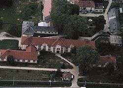 Aerial view of Győrtelek
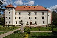 Vay Mansion in Vaja
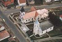 Aerial view of Mérk
 Park in Mátészalka
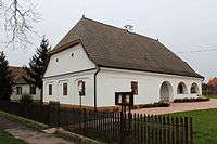 Reformed Parsonage in Ököritófülpös
See also
References
- ↑ A KSH 2013. évi helységnévkönyve
- ↑ népesség.com, "Mátészalkai járás népessége"
- ↑ 4.1.6.1 A népesség nemzetiség szerint, 2011, (in Hungarian)
- ↑ 4.1.7.1 A népesség vallás, felekezet szerint, 2011, (in Hungarian)
External links
| Towns (3) |
| |
|---|---|---|
| Large villages (3) | ||
| Villages (20) | ||
Coordinates: 47°55′00″N 22°20′00″E / 47.9167°N 22.3333°E