Luthrie
| Luthrie | |
|---|---|
| village | |
 | |
 Luthrie | |
| Coordinates: 56°21′53″N 3°05′05″W / 56.364638°N 3.084701°WCoordinates: 56°21′53″N 3°05′05″W / 56.364638°N 3.084701°W[1] | |
| Country | Scotland |
| County | Fife |
| Parish | Creich |
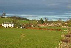
Luthrie is a village in the parish of Creich in Fife, Scotland. A small stream shown on maps as Windygates Burn (but know locally as Luthrie Burn) flows through the village and occasionally floods.[2][3]
Notable buildings
Listed
There are two listed buildings in the village, both Grade C(S):
- Old Smiddy House c. 1790 56°21′49″N 3°05′03″W / 56.36374°N 3.08421°W[4][5]
- Lower Luthrie House a two-storey, four-window harled dated c. 1800 (marked Luthrie House on most maps) 56°21′45″N 3°04′58″W / 56.36239°N 3.08266°W[6][7]
Other
- Old School House 56°21′51″N 3°05′07″W / 56.36421°N 3.08540°W[8]
- Village Hall 56°21′51″N 3°05′04″W / 56.36417°N 3.08442°W[9]
See also
External links
References
- ↑ "Side by side georeferenced maps viewer - Map images - National Library of Scotland". nls.uk.
- ↑ "Where's The Path 3". wtp2.appspot.com.
- ↑ "Clear-up in southern Scotland as flood alerts continue". BBC News.
- ↑ "Historic Scotland Data Website - Listed Buildings: OLD SMIDDY HOUSE LUTHRIE". historic-scotland.gov.uk.
- ↑ "Lower Luthrie House (luthrie House on Map) - Luthrie - Fife - Scotland - British Listed Buildings". britishlistedbuildings.co.uk.
- ↑ "Historic Scotland Data Website - Listed Buildings: LOWER LUTHRIE HOUSE (LUTHRIE HOUSE ON MAP)". historic-scotland.gov.uk.
- ↑ "Old Smiddy House Luthrie - Luthrie - Fife - Scotland - British Listed Buildings". britishlistedbuildings.co.uk.
- ↑ Ron Taylor. "Creich School Luthrie (C) Ron Taylor :: Geograph Britain and Ireland". geograph.org.uk.
- ↑ "Luthrie Village Hall". luthrievillagehall.org.uk.
This article is issued from
Wikipedia.
The text is licensed under Creative Commons - Attribution - Sharealike.
Additional terms may apply for the media files.