Luddenden
| Luddenden | |
|---|---|
 View looking west across Luddenden village showing Oats Royd Mill to the right and Old Lane to the left | |
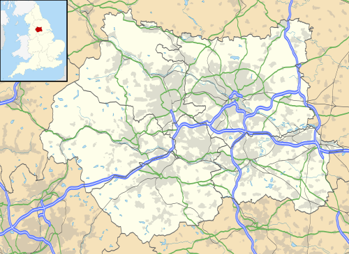 Luddenden Luddenden shown within West Yorkshire | |
| OS grid reference | SE045265 |
| Metropolitan borough | |
| Metropolitan county | |
| Region | |
| Country | England |
| Sovereign state | United Kingdom |
| Post town | HALIFAX |
| Postcode district | HX2 |
| Dialling code | 01422 |
| Police | West Yorkshire |
| Fire | West Yorkshire |
| Ambulance | Yorkshire |
| EU Parliament | Yorkshire and the Humber |
Luddenden is a district of Calderdale 3.1 miles (5 km) west of Halifax[1] on the Luddenden Brook in the county of West Yorkshire, England.[2]
History
The name means Ludd valley, or valley of the loud stream and refers to the Luddenden Brook.[3] An alternative meaning refers to the Celtic water god Lud, who gave his name to many water-related features. This was a Brythonic area, speaking a form of primitive Welsh, until perhaps the 9th century as a relict of the kingdom of Elmet.
The spellings Ludingdene, Luddington and Luddyngden are found.
The community is first mentioned in 1274 when a manorial roll in Wakefield described a corn mill operating in Luddenden to grind corn from the east side of the valley.[4] In 1375, a corn mill was moved from Warley Town to exploit the Luddenden Brook. With the introduction of water power, many textile mills were established in the district.[4]
The cobbled packhorse trail which runs through the village, down Old Lane from Midgley, crossing the river and on up Halifax Lane to Warley, was once the equivalent of the modern day M62, providing a major goods route through the Pennines when the main mode of transport was packhorses. This started to change from 1760 as the government approved a Turnpike road to be constructed through the Calder Valley.[5] In the 17th century the village, along with the other locations in the Luddenden Brook valley, became prosperous through the worsted industry.[6] To enable water to be supplied to the 11 mills in the valley, the Cold Edge Dam Company was formed to build the reservoirs at the head of the valley.[5]
The area, alongside the West Yorkshire village of Bramham, West Yorkshire was used for filming external scenes in the 1980s ITV Yorkshire Television situation comedy series In Loving Memory, starring Dame Thora Hird and Christopher Beeny.[7]
In May 1989, an extreme rainfall event was recorded at 7.6 inches (192 mm) over the course of two hours at the Walshaw Dean rainfall gauge. The resultant flood, one of the worst seen in Calderdale, drove a huge amount of water through the village which damaged roads, houses and industrial premises. The 1 in a 1,000 event took over six months to recover from.[8][9]
The village has a church "St Mary's", and a very old pub "The Lord Nelson", both of which are Grade II listed.[10][11] The pub is where Branwell Brontë once drank and the pub itself is asserted to have established the first public library in one of the upstairs rooms.[12]
In recent years the village has reestablished the position of Village Mayor, the role is primarily about raising funds for local charitable causes and investment in the village.[13]
A regular and strong candidate in the Yorkshire in Bloom competition since 1998, the village has won an award every year since (except 2008 and 2009 when they did not enter) winning five gold and three silver medals up until 2013.[14][15]
There is also a digital television and analogue radio transmitter for the local area, it broadcasts BBC National Radio and BBC Radio Leeds to the South and East to Halifax, Sowerby Bridge and as far south as Rishworth. The television services are directed North, West and South.
On 29 July 2017 the Twitter handle https://twitter.com/LuddendenNHW formally registered with https://www.ourwatch.org.uk/. On 12 November 2017 the handle was invited to the National Police Awards 2017.
Governance
The settlement is part of the Luddendenfoot ward of the Metropolitan borough of Calderdale, part of the Metropolitan county of West Yorkshire.[16]
References
- ↑ "OL21" (Map). South Pennines (A2 ed.). 1:25,000. Explorer. Ordnance Survey. 2008. ISBN 978-0-319-24012-0.
- ↑ "Luddenden Brook from Source to River Calder". Environment Agency. Retrieved 30 May 2017.
- ↑ Smith, A H (1962). The place names of the West Riding of Yorkshire part VII (1 ed.). Cambridge: Cambridge University Press. p. 92.
- 1 2 LCA 2013, p. 5.
- 1 2 LCA 2013, p. 6.
- ↑ "Weekend Walk: The Luddenden Valley". The Yorkshire Post. 23 January 2016. Retrieved 30 May 2017.
- ↑ Ledger, John (26 January 2016). "Dad's Army and 25 other glorious Yorkshire screen gems". The Yorkshire Post. Retrieved 30 May 2017.
- ↑ "Calderdale Metropolitan Borough Council Draft Preliminary Flood Risk Assessment" (PDF). calderdale.gov. Calderdale Council. April 2011. p. 21. Retrieved 30 May 2017.
- ↑ "Local Flood Risk Management Strategy" (PDF). calderdale.gov. Calderdale Council. June 2016. p. 15. Retrieved 30 May 2017.
- ↑ Historic England. "Church of St Mary the Blessed Virgin (Grade II) (1134509)". National Heritage List for England. Retrieved 31 May 2017.
- ↑ Historic England. "Lord Nelson Inn (Grade II) (1134506)". National Heritage List for England. Retrieved 31 May 2017.
- ↑ Thomas, Peter (2005). Yorkshire's historic pubs (1 ed.). Stroud: Sutton Publishing. pp. 78–79. ISBN 0-7509-3983-4.
- ↑ Thomas, Peter (2005). Yorkshire's historic pubs (1 ed.). Stroud: Sutton Publishing. p. 79. ISBN 0-7509-3983-4.
- ↑ "Luddenden In Bloom". Luddenden. 26 October 2010. Retrieved 30 May 2017.
- ↑ "BBC visit the Luddenden landscape". The Halifax Courier. 28 July 2006. Retrieved 30 May 2017.
- ↑ "Luddendenfoot". 2010. Retrieved 20 January 2014.
Sources
Luddenden Conservation Area (PDF) (Report). Halifax: Calderdale Council. 2013.
- Vikki Egerton. Luddenden Saga: A Brief History of a Yorkshire Village
- Mark Lewisohn. The Radio Times Guide to Television Comedy
External links
| Wikimedia Commons has media related to Luddenden. |