Lucky Boy, Nevada
| Lucky Boy | |
|---|---|
| Ghost town | |
 Lucky Boy Location within the state of Nevada  Lucky Boy Lucky Boy (the US) | |
| Coordinates: 38°27′37″N 118°40′44″W / 38.46028°N 118.67889°WCoordinates: 38°27′37″N 118°40′44″W / 38.46028°N 118.67889°W | |
| Country | United States |
| State | Nevada |
| County | Mineral |
| Elevation | 6,214 ft (1,894 m) |
| Time zone | UTC-8 (Pacific (PST)) |
| • Summer (DST) | UTC-7 (PDT) |
| GNIS feature ID | 860437[1] |
Lucky Boy was a town in Mineral County, Nevada, approximately 5 mi (8.0 km) southwest of Hawthorne.
The Lucky Boy Mine was located east of the town[2] on the east slope of the Wassuk Range, discovered by men repairing a stage road over a pass. A post office was established March 19, 1909 and discontinued October 31, 1913.[3]
A serious stage coach accident occurred near Lucky Boy in 1909, when "six spirited horses took fright" and then "dragged the passengers down a steep grade at lightning speed".[4]
References
- ↑ "Lucky Boy". Geographic Names Information System. United States Geological Survey.
- ↑ "Lucky Boy Mine". Geographic Names Information System. United States Geological Survey.
- ↑ Carlson, Helen S. (1985). Nevada place names : a geographical dictionary. Reno: University of Nevada Press. p. 159. ISBN 0-87417-094-X.
- ↑ "Terrible Stage Accident Near Reno". Deseret News. October 15, 1909.
External links
Municipalities and communities of Mineral County, Nevada, United States | ||
|---|---|---|
| CDPs | 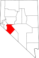 | |
| Unincorporated community | ||
| Indian reservation | ||
| Ghost towns | ||
This article is issued from
Wikipedia.
The text is licensed under Creative Commons - Attribution - Sharealike.
Additional terms may apply for the media files.