Lucas Janszoon Waghenaer

Lucas Janszoon Waghenaer (1533/34 – 1606) was a Dutch chief officer and cartographer who was born in Enkhuizen.
He is one of the founding fathers and most famous members of the North Holland school, which played a major role in the early development of Dutch nautical chart-making. Between 1550 and 1579 Waghenaer sailed the seas as a chief officer. During these years he must have been in contact with Portuguese, Spanish and Italian seafarers. The knowledge on maritime charts and sailing instructions that he gained from these contacts were of great influence on his later work. After his career as active seafarer, he started working in the port of Enkhuizen as collector of maritime dues.
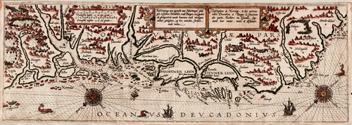
His first publication appeared in 1584, and was called 'Spieghel der zeevaerdt' ('Mariner's mirror'). This chart-book combined an atlas of nautical charts and sailing directions with instructions for navigation on the western and north-western coastal waters of Europe. It was the first of its kind in the history of maritime cartography, and was an immediate success. A second part was published the next year. The 'Spieghel der zeevaerdt' was reprinted several times, and translated into English, German, Latin and French. In 1592 his second pilot book, Thresoor der Zeevaert ('Treasure of navigation'), was published. His third and last publication, the Enchuyser zeecaertboeck ('Enkhuizen sea-chart-book') came out in 1598.
Lucas Janszoon Waghenaer died in 1606 Enkhuizen in apparent poverty, moving the municipal authorities to extend his pension a year longer for his widow.[1][2]
For his pioneering contributions in the history of maritime cartography, Waghenaer is considered one of the notable figures in the Golden Age of Dutch/Netherlandish cartography (c. 1570s–1670s).
Literature
- (NL) Lucas Janszoon Waghenaer, "T'eerste deel vande Spieghel der zeevaerdt, van de navigatie der Westersche zee, innehoudende alle de custen van Vranckrijck, Spaingen ende 't principaelste deel van Engelandt, in diversche zee caerten begrepen", Leiden, Christoffel Plantijn, 1584.
See also
References
- ↑ Ligue des Bibliothèques Europeénnes de Recherche, Groupe des Cartothécaires de LIBER "Archived copy". Archived from the original on 2007-06-09. Retrieved 2007-10-30.
- ↑ Koeman, C. Lucas Janszoon Waghenaer: A Sixteenth Century Marine Cartographer The Geographical Journal, Vol. 131, No. 2. (Jun., 1965), pp. 202-212.
External links
| Authority control |
|---|