Louts
| Louts | |
|---|---|
 | |
| Country | France |
| Physical characteristics | |
| Main source | North of Pau |
| River mouth |
Adour 43°44′27″N 0°56′1″W / 43.74083°N 0.93361°WCoordinates: 43°44′27″N 0°56′1″W / 43.74083°N 0.93361°W |
| Length | 86 km (53 mi) |
| Basin features | |
| Progression | Adour→ Atlantic Ocean |
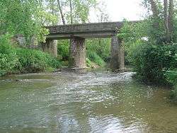
The Louts, is a left tributary of the Adour, in Aquitaine, in the Southwest of France.
Name
It is documented in medieval Latin as Fluvius qui dicitur Lossium.[1]
Geography
The Louts rises in Thèze, flows northwest through Chalosse and joins the Adour, in Hinx.
Départements and towns
- Pyrénées-Atlantiques : Thèze, Arzacq-Arraziguet, Lème, Méracq, Vignes.
- Landes : Hagetmau, Saint-Cricq-Chalosse, Caupenne.
References
- ↑ (Gallia Christiana 12th century; with the usual permutation of the place of the i).
External links
This article is issued from
Wikipedia.
The text is licensed under Creative Commons - Attribution - Sharealike.
Additional terms may apply for the media files.