Lordegan County
| Lordegan County شهرستان لردگان | |
|---|---|
| County | |
 Location in Chaharmahal and Bakhtiari Province | |
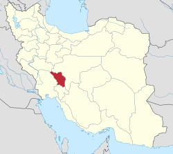 Location of Chaharmahal and Bakhtiari Province in Iran | |
| Coordinates: 31°26′N 50°50′E / 31.433°N 50.833°ECoordinates: 31°26′N 50°50′E / 31.433°N 50.833°E | |
| Country |
|
| Province | Chaharmahal and Bakhtiari Province |
| Capital | Lordegan |
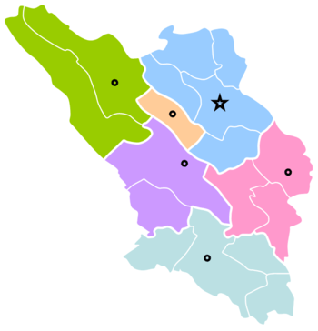
| Bakhsh (Districts) | Central District, Falard District, Manj District, Khanmirza District |
| Population (2006) | |
| • Total | 175,289 |
| Time zone | UTC+3:30 (IRST) |
| • Summer (DST) | UTC+4:30 (IRDT) |
| Lordegan County can be found at GEOnet Names Server, at this link, by opening the Advanced Search box, entering "9206273" in the "Unique Feature Id" form, and clicking on "Search Database". | |
Lordegan County (Persian: شهرستان لردگان) is a county in Chaharmahal-o-Bakhtiari Province in Iran. The capital of the county is Lordegan. At the 2006 census, the county's population was 175,289, in 34,603 families.[1] The county contains four districts: the Central District, Manj District, Falard District, and Khanmirza District. The county has three cities: Lordegan, Mal-e Khalifeh, Manj-e Nesa and Aluni.
People
Bakhtiari tribes are predominant inhabitants of Lordegan county.
Language
People mainly speak Lurish language by Bakhtiari dialect, which is a member of Southwestern Iranian languages.
References
- ↑ "Census of the Islamic Republic of Iran, 1385 (2006)". Islamic Republic of Iran. Archived from the original (Excel) on 2011-11-11.
- اطلس گیتاشناسی استانهای ایران [Atlas Gitashenasi Ostanhai Iran] (Gitashenasi Province Atlas of Iran)
| Capital |  | ||||||||||||||
|---|---|---|---|---|---|---|---|---|---|---|---|---|---|---|---|
| Counties and cities |
| ||||||||||||||
| Landmarks |
| ||||||||||||||
| populated places | |||||||||||||||
This article is issued from
Wikipedia.
The text is licensed under Creative Commons - Attribution - Sharealike.
Additional terms may apply for the media files.