Loppa (island)
| Native name: Láhppi | |
|---|---|
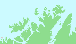 | |
 Loppa Location of the island  Loppa Loppa (Norway) | |
| Geography | |
| Location | Finnmark, Norway |
| Coordinates | 70°21′31″N 21°24′50″E / 70.3586°N 21.4139°ECoordinates: 70°21′31″N 21°24′50″E / 70.3586°N 21.4139°E |
| Area | 12 km2 (4.6 sq mi) |
| Length | 7.5 km (4.66 mi) |
| Width | 2.5 km (1.55 mi) |
| Highest elevation | 289 m (948 ft) |
| Highest point | Rektind |
| Administration | |
|
Norway | |
| County | Finnmark |
| Municipality | Loppa Municipality |
Loppa (Northern Sami: Láhppi) is an island in Loppa Municipality in Finnmark county, Norway.[1] The 12-square-kilometre (4.6 sq mi) island lies in the Lopphavet Sea in the western part of the municipality, west of the island of Silda. The small island has one village area (called Loppa) on the southeastern coast. This village used to be the administrative centre of Loppa and an important fishing village for the municipality, but all of the administration of the village was moved to Øksfjord on the mainland. Today, Loppa Church is still located in this village, but there are only a few residents remaining on the island. In 1983, a seabird reserve was established along the western cliffs.[2]
See also
References
- ↑ "Loppa" (in Norwegian). yr.no. Retrieved 2013-01-01.
- ↑ Askheim, Svein, ed. (2017-10-02). "Loppa øy". Store norske leksikon (in Norwegian). Kunnskapsforlaget. Retrieved 2018-06-23.
This article is issued from
Wikipedia.
The text is licensed under Creative Commons - Attribution - Sharealike.
Additional terms may apply for the media files.