Lomba (Lajes das Flores)
| Lomba | |
| Civil Parish | |
| Official name: Freguesia da Lomba | |
| Name origin: Portuguese for hill | |
| Country | |
|---|---|
| Region | |
| Island | Flores |
| Municipality | Lajes das Flores |
| Localities | Lomba |
| Center | Lomba |
| - elevation | 197 m (646 ft) |
| - coordinates | 39°24′5″N 31°9′23″W / 39.40139°N 31.15639°WCoordinates: 39°24′5″N 31°9′23″W / 39.40139°N 31.15639°W |
| Highest point | Caldeira da Lomba |
| - location | Cerrado do Soldado |
| - elevation | 672 m (2,205 ft) |
| - coordinates | 39°25′32″N 31°11′23″W / 39.42556°N 31.18972°W |
| Lowest point | Sea level |
| - location | Atlantic Ocean |
| - elevation | 0 m (0 ft) |
| Area | 9.87 km2 (4 sq mi) |
| - water | .02 km2 (0 sq mi) |
| - urban | .11 km2 (0 sq mi) |
| Population | 206 (2011) |
| Density | 21/km2 (54/sq mi) |
| Settlement | fl.1510 |
| LAU | Junta Freguesia |
| - location | Rua da Cruz |
| - coordinates | 39°24′4″N 31°9′26″W / 39.40111°N 31.15722°W |
| President Junta | José Maria Freitas Reis (PS) |
| President Assembleia | Francisco Mendonça de Freitas (PS) |
| Timezone | Azores (UTC-1) |
| - summer (DST) | Azores (UTC0) |
| Postal Zone | 9960-500 |
| Area Code & Prefix | (+351) 292 XXX-XXXX |
| Patron Saint | São Caetano |
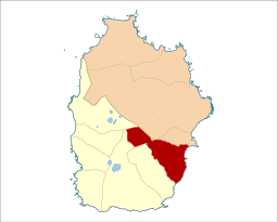 Location of the civil parish seat of Lomba in the municipality of Lajes das Flores | |
| Website: www | |
| Geographic detail from Instituto Geográfico Português (2010) | |
Lomba is a civil parish in the municipality of Lajes das Flores on the island of Flores in the Portuguese archipelago of the Azores. The population in 2011 was 206,[1] in an area of 9.87 square kilometres (3.81 sq mi).[2]
History
The religious parish, since 1698, was established to the invocation of Saint Cajetan of Thiene, at the time a population of 750 residents (during the 19th century).
Geography
The civil parish is located on the east-southeast coast of the island, and confined by the parishes Fazenda (to the south) and Caveira (in the north), approximately 5 kilometers from the municipal seat, along the margins of Ribeira da Silva on the border of the municipality. Its taxonomy was derived from its location; Lomba was located on a high precipice over the ocean, delimited by valleys on either side (lomba is the Portuguese term for hill), and was once called Lomba da Boa Vista.
Architecture
Civic
- Agricultural sheds Rua do Cabeço (Portuguese: Estaleiros da Rua do Cabeç)
- Fountain of Lomba (Portuguese: Chafariz da Lomba)
- Hayloft of Quateiro (Portuguese: Palheiro ao Quarteiro)
- Port of Lomba (Portuguese: Porto da Lomba)
- Residence of Maurício Vieira (Portuguese: Casa do Maurício Vieira)
- Residence Rua da Terra Chã (Portuguese: Casa de Habitação da Rua da Terra Chã)
Religious
- Church of São Caetano (Portuguese: Igreja Paroquial de Lomba/Igreja de São Caetano), the parochial church dates to 1698, but the current structure was constructed during the 18th century, based on a common three-register structure prevalent in the region, that includes a steeple/belfry.[3][4]
- Funeral Monumento (Portuguese: Monumento Funerario do Cemitério da Lomba)
- Império of the Divine Holy Spirit of Lomba (Portuguese: Império do Divino Espírito Santo da Lomba)
References
- ↑ Instituto Nacional de Estatística
- ↑ Eurostat Archived 2014-09-06 at the Wayback Machine.
- ↑ Noé, Paula (2011), SIPA, ed., Igreja Paroquial de Lomba/Igreja de São Caetano (IPA.00032437/PT072003060009) (in Portuguese), Lisbon, Portugal: SIPA – Sistema de Informação para o Património Arquitectónico, retrieved 22 December 2016
- ↑ DRC, ed. (9 November 2003), "82.8.58 Igreja de São Caetano", Inventário do Património Imóvel dos Açores, Angra do Heroísmo (Azores), Portugal: Direção Regional da Cultura