Lofall, Washington
| Lofall, Washington | |
|---|---|
| CDP | |
 Lofall, Washington | |
| Coordinates: 47°48′38″N 122°39′07″W / 47.81056°N 122.65194°WCoordinates: 47°48′38″N 122°39′07″W / 47.81056°N 122.65194°W | |
| Country | United States |
| State | Washington |
| County | Kitsap |
| Area | |
| • Total | 2.00 sq mi (5.2 km2) |
| Elevation | 115 ft (35 m) |
| Population (2010) | |
| • Total | 2,289 |
| • Density | 1,100/sq mi (440/km2) |
| Time zone | Pacific |
| Area code(s) | 360 |
Lofall is a CDP located in Kitsap County, Washington.[1]. The population was 2,289 at the 2010 census.
A post office called Lofall was established in 1912, and remained in operation until 1934.[2] The community was named after H. Lofall, the original owner of the town site.[3]
Demographics
In 2010, it had a population of 2,289 inhabitants. 1,202 are male. 1,087 are female.[4]
Geography
Lofall is located at coordinates 47°48′38″N 122°39′07″W.
References
- ↑ "Lofall". Geographic Names Information System. United States Geological Survey.
- ↑ "Post Offices". Jim Forte Postal History. Retrieved 14 August 2016.
- ↑ Meany, Edmond S. (1923). Origin of Washington geographic names. Seattle: University of Washington Press. p. 149.
- ↑ "Lofall, Washington". Retrieved 19 August 2014.
Municipalities and communities of Kitsap County, Washington, United States | ||
|---|---|---|
| Cities | 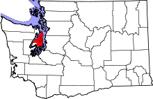 | |
| CDPs | ||
| Other unincorporated communities | ||
| Indian reservation | ||
This article is issued from
Wikipedia.
The text is licensed under Creative Commons - Attribution - Sharealike.
Additional terms may apply for the media files.