Litava
| Litava | |
| Village | |
| Country | Slovakia |
|---|---|
| Region | Banská Bystrica |
| District | Krupina |
| Tourism region | Hont |
| Coordinates | 48°17′56″N 19°10′46″E / 48.29889°N 19.17944°ECoordinates: 48°17′56″N 19°10′46″E / 48.29889°N 19.17944°E |
| Area | 22.13 km2 (9 sq mi) |
| Population | 767 (31. 12. 2015) |
| Density | 35/km2 (91/sq mi) |
| First mentioned | 1135 |
| Mayor | Ľubica Tuhárska |
| Timezone | CET (UTC+1) |
| - summer (DST) | CEST (UTC+2) |
| Postal code | 962 44 |
| Phone prefix | 421-45 |
| Car plate | KA |
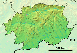 Location of Litava in the Banská Bystrica Region  Litava (Slovakia) | |
| Wikimedia Commons: Litava | |
| Website: http://www.obeclitava.sk | |
Litava is a village and municipality in the Krupina District of the Banská Bystrica Region of Slovakia.
History
The village was mentioned for the first time in a document from 1135. Already in this year a Romanesque chapel was present in the village. With the presence of this church, the village served as a kind of spiritual, cultural and social center of the region since the 12th century. In the 15th century Litava was a tolling point. In 1496 already the village had its own mill. In 1613 a wooden school stood in the middle of the village which was rebuilt into a brick school in 1811.[1]
References
This article is issued from
Wikipedia.
The text is licensed under Creative Commons - Attribution - Sharealike.
Additional terms may apply for the media files.