List of trails of Beaverhead County, Montana
There are at least 20 named trails in Beaverhead County, Montana according to the U.S. Geological Survey, Board of Geographic Names. A trail is defined as: "Route for passage from one point to another; does not include roads or highways (jeep trail, path, ski trail)."[1]
- Alder Creek Trail, 45°44′26″N 113°10′17″W / 45.74056°N 113.17139°W, el. 8,261 feet (2,518 m) [2]
- Blue Creek Trail, 45°27′56″N 113°10′12″W / 45.46556°N 113.17000°W, el. 7,848 feet (2,392 m) [3]
- Bobcat Lakes Trail, 45°36′30″N 113°12′07″W / 45.60833°N 113.20194°W, el. 8,261 feet (2,518 m) [4]
- Bull Creek Polecreek Trail, 45°23′01″N 113°13′49″W / 45.38361°N 113.23028°W, el. 8,074 feet (2,461 m) [5]
- Copper Creek Trail, 45°39′05″N 113°11′44″W / 45.65139°N 113.19556°W, el. 8,205 feet (2,501 m) [6]
- Cornell Trail, 44°48′05″N 112°14′44″W / 44.80139°N 112.24556°W, el. 8,717 feet (2,657 m) [7]
- Driveway Trail, 45°27′31″N 113°05′26″W / 45.45861°N 113.09056°W, el. 7,526 feet (2,294 m) [8]
- Gold Creek Trail, 45°36′19″N 112°58′31″W / 45.60528°N 112.97528°W, el. 8,074 feet (2,461 m) [9]
- Grassy Lake Trail, 45°36′46″N 113°13′56″W / 45.61278°N 113.23222°W, el. 8,717 feet (2,657 m) [10]
- Hidden Pasture Trail, 44°42′09″N 112°47′00″W / 44.70250°N 112.78333°W, el. 8,087 feet (2,465 m) [11]
- Hiline Trail, 45°44′20″N 113°11′33″W / 45.73889°N 113.19250°W, el. 8,366 feet (2,550 m) [12]
- Lodgepole Trail, 44°48′36″N 112°08′57″W / 44.81000°N 112.14917°W, el. 8,097 feet (2,468 m) [13]
- Old Tim Creek Trail, 45°28′34″N 113°13′38″W / 45.47611°N 113.22722°W, el. 7,559 feet (2,304 m) [14]
- Pole Creek Trail, 45°24′36″N 113°11′52″W / 45.41000°N 113.19778°W, el. 8,058 feet (2,456 m) [15]
- Rhubarb Patch Trail, 45°26′24″N 113°05′07″W / 45.44000°N 113.08528°W, el. 7,165 feet (2,184 m) [16]
- Sawtooth Trail, 44°48′22″N 112°13′35″W / 44.80611°N 112.22639°W, el. 9,134 feet (2,784 m) [17]
- Shoestring Creek Bear Wallow Creek Trail, 45°29′35″N 113°10′45″W / 45.49306°N 113.17917°W, el. 8,113 feet (2,473 m) [18]
- Snowcrest Trail, 44°48′48″N 112°06′14″W / 44.81333°N 112.10389°W, el. 9,836 feet (2,998 m) [19]
- Stine Creek Trail, 45°44′10″N 113°03′05″W / 45.73611°N 113.05139°W, el. 7,697 feet (2,346 m) [20]
- Table Mountain Trail, 44°31′39″N 112°01′56″W / 44.52750°N 112.03222°W, el. 8,855 feet (2,699 m) [21]
Further reading
- Arthur, Jean (2000). Winter Trails Montana: The Best Cross-Country Ski & Snowshoe Trails. Guilford, CT: Globe Pequot. ISBN 0-7627-0730-5.
- Spring, Ira (1974). Wilderness trails Northwest;: A hiker's and climber's overview-guide to national parks and wilderness areas in Wyoming, Montana, Idaho, Northern California, . British Columbia, Canadian Rockies. Touchstone Press. ISBN 0-911518-25-8.
- Willard, John A. (1986). Adventure Trails in Montana. Pruett Publishing Co. ISBN 0-87108-726-X.
- Howard, Lynna and Leland (2000). Along Montana & Idaho's Continental Divide Trail. Westcliff Publishers. ISBN 1-56579-343-9.
- Wolf, John R. (1992). Guide to the Continental Divide Trail: Northern Montana. Continental Divide Trail Society. ISBN 0-934326-01-0.
- Barnett, Carellen (1997). Trail Riding Western Montana. Guilford, CT: Falcon Press Publishing. ISBN 1-56044-336-7.
- Schneider, Bill (1995). Hiking Montana. Guilford, CT: Falcon Press Publishing. ISBN 1-56044-381-2.
See also
Notes
- ↑ "Geographic Names Information System (GNIS) Feature Class Definitions". U.S. Geological Survey. Retrieved 2011-07-26.
- ↑ "Alder Creek Trail". Geographic Names Information System. United States Geological Survey.
- ↑ "Blue Creek Trail". Geographic Names Information System. United States Geological Survey.
- ↑ "Bobcat Lakes Trail". Geographic Names Information System. United States Geological Survey.
- ↑ "Bull Creek Polecreek Trail". Geographic Names Information System. United States Geological Survey.
- ↑ "Copper Creek Trail". Geographic Names Information System. United States Geological Survey.
- ↑ "Cornell Trail". Geographic Names Information System. United States Geological Survey.
- ↑ "Driveway Trail". Geographic Names Information System. United States Geological Survey.
- ↑ "Gold Creek Trail". Geographic Names Information System. United States Geological Survey.
- ↑ "Grassy Lake Trail". Geographic Names Information System. United States Geological Survey.
- ↑ "Hidden Pasture Trail". Geographic Names Information System. United States Geological Survey.
- ↑ "Hiline Trail". Geographic Names Information System. United States Geological Survey.
- ↑ "Lodgepole Trail". Geographic Names Information System. United States Geological Survey.
- ↑ "Old Tim Creek Trail". Geographic Names Information System. United States Geological Survey.
- ↑ "Pole Creek Trail". Geographic Names Information System. United States Geological Survey.
- ↑ "Rhubarb Patch Trail". Geographic Names Information System. United States Geological Survey.
- ↑ "Sawtooth Trail". Geographic Names Information System. United States Geological Survey.
- ↑ "Shoestring Creek Bear Wallow Creek Trail". Geographic Names Information System. United States Geological Survey.
- ↑ "Snowcrest Trail". Geographic Names Information System. United States Geological Survey.
- ↑ "Stine Creek Trail". Geographic Names Information System. United States Geological Survey.
- ↑ "Table Mountain Trail". Geographic Names Information System. United States Geological Survey.
Municipalities and communities of Beaverhead County, Montana, United States | ||
|---|---|---|
| City | 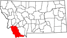 | |
| Town | ||
| CDP | ||
| Ghost towns | ||
| Unincorporated communities | ||
This article is issued from
Wikipedia.
The text is licensed under Creative Commons - Attribution - Sharealike.
Additional terms may apply for the media files.