List
| Name |
Location |
Date Listed |
Grid Ref. [note 1] |
Geo-coordinates |
Notes |
HB Number [note 2] |
Image |
| Novar House Entrance Gates (East) |
|
|
|
57°40′28″N 4°19′07″W / 57.674315°N 4.318642°W / 57.674315; -4.318642 (Novar House Entrance Gates (East)) |
Category B |
341 |

|
| Alness, Novar Road Dunain |
|
|
|
57°41′41″N 4°15′53″W / 57.694618°N 4.264765°W / 57.694618; -4.264765 (Alness, Novar Road Dunain) |
Category B |
359 |
|
| Alness, 28 Novar Road Victoria House |
|
|
|
57°41′44″N 4°15′43″W / 57.695585°N 4.261956°W / 57.695585; -4.261956 (Alness, 28 Novar Road Victoria House) |
Category B |
362 |
|
| Alness, 20, 22, 24, 26 Novar Road |
|
|
|
57°41′45″N 4°15′40″W / 57.695824°N 4.261182°W / 57.695824; -4.261182 (Alness, 20, 22, 24, 26 Novar Road) |
Category B |
363 |
|
| Novar House And Walled Gardens |
|
|
|
57°40′48″N 4°19′32″W / 57.680089°N 4.32567°W / 57.680089; -4.32567 (Novar House And Walled Gardens) |
Category B |
338 |
|
| Novar, Water Baillie's House |
|
|
|
57°40′52″N 4°19′50″W / 57.680979°N 4.330558°W / 57.680979; -4.330558 (Novar, Water Baillie's House) |
Category C(S) |
339 |
|
| Alness Bridge Over River Averon Or Alness On A9 Road |
|
|
|
57°41′47″N 4°15′33″W / 57.69631°N 4.259082°W / 57.69631; -4.259082 (Alness Bridge Over River Averon Or Alness On A9 Road) |
Category B |
356 |
|
| Alness, Novar Road Parish Hall |
|
|
|
57°41′43″N 4°15′47″W / 57.695206°N 4.26304°W / 57.695206; -4.26304 (Alness, Novar Road Parish Hall) |
Category B |
361 |
|
| Alness Old Manse |
|
|
|
57°41′27″N 4°16′37″W / 57.690735°N 4.276855°W / 57.690735; -4.276855 (Alness Old Manse) |
Category B |
364 |
|
| Alness 3 Novar Road |
|
|
|
57°41′46″N 4°15′35″W / 57.696065°N 4.259771°W / 57.696065; -4.259771 (Alness 3 Novar Road) |
Category C(S) |
357 |
|
| Alness, 92-94 (Even Nos) High Street, Station Hotel |
|
|
|
57°41′44″N 4°15′06″W / 57.695444°N 4.251745°W / 57.695444; -4.251745 (Alness, 92-94 (Even Nos) High Street, Station Hotel) |
Category B |
44781 |
|
| Teaninich House |
|
|
|
57°41′23″N 4°15′53″W / 57.689651°N 4.26469°W / 57.689651; -4.26469 (Teaninich House) |
Category B |
342 |
|
| Alness, 62 Novar Road |
|
|
|
57°41′41″N 4°15′53″W / 57.694657°N 4.2646°W / 57.694657; -4.2646 (Alness, 62 Novar Road) |
Category C(S) |
360 |
|
| Assynt House |
|
|
|
57°40′19″N 4°21′42″W / 57.671982°N 4.361693°W / 57.671982; -4.361693 (Assynt House) |
Category B |
368 |
|
| Moultavie House |
|
|
|
57°42′38″N 4°17′52″W / 57.710474°N 4.297871°W / 57.710474; -4.297871 (Moultavie House) |
Category C(S) |
371 |
|
| Alness Old Parish Church And Burial Ground |
|
|
|
57°41′28″N 4°16′30″W / 57.691013°N 4.274926°W / 57.691013; -4.274926 (Alness Old Parish Church And Burial Ground) |
Category B |
365 |
|
| Alness Railway Viaduct Over River Averon Or Alness |
|
|
|
57°41′43″N 4°15′30″W / 57.695219°N 4.258292°W / 57.695219; -4.258292 (Alness Railway Viaduct Over River Averon Or Alness) |
Category B |
366 |
|
| Novar Stables |
|
|
|
57°40′50″N 4°19′46″W / 57.680427°N 4.329315°W / 57.680427; -4.329315 (Novar Stables) |
Category C(S) |
340 |
|
| Alness, Novar Road Bridgend |
|
|
|
57°41′46″N 4°15′34″W / 57.696123°N 4.259506°W / 57.696123; -4.259506 (Alness, Novar Road Bridgend) |
Category C(S) |
358 |
|
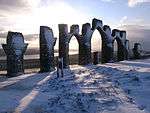
| Fyrish Monument |
|
|
|
57°41′44″N 4°20′15″W / 57.695602°N 4.337623°W / 57.695602; -4.337623 (Fyrish Monument) |
Category B |
369 |
 Upload another image
|
| Morvern House Hotel (Former Free Church Manse) |
|
|
|
57°41′42″N 4°15′59″W / 57.69502°N 4.266418°W / 57.69502; -4.266418 (Morvern House Hotel (Former Free Church Manse)) |
Category C(S) |
370 |
|
Key
The scheme for classifying buildings in Scotland is:
- Category A: "buildings of national or international importance, either architectural or historic; or fine, little-altered examples of some particular period, style or building type."[1]
- Category B: "buildings of regional or more than local importance; or major examples of some particular period, style or building type, which may have been altered."[1]
- Category C: "buildings of local importance; lesser examples of any period, style, or building type, as originally constructed or moderately altered; and simple traditional buildings which group well with other listed buildings."[1]
In March 2016 there were 47,288 listed buildings in Scotland. Of these, 8 per cent were Category A, and 50 per cent were Category B, with the rest listed at Category C.[2]