List of highway strips in North Korea

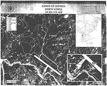
CIA image showing the Sunan-Up airstrip in 1968

North Korea has built dozens of reserve airstrips along highways and ordinary roads. These airfields are little more than widened sections of pavement that appear to be for emergency or backup use only and may not normally support operations. They are listed as "Highway" or "Highway Strip".[1][2]

Highway Airstrips in North Korea
Name Runway Dimensions (ft) Dimensions (m) Surface Coordinates
Ayang Ni 10/286400 x 791951 x 24Gravel38°15′06.30″N 125°57′50.70″E / 38.2517500°N 125.9640833°E / 38.2517500; 125.9640833
Changyon 14/322850 x 102869 x 36Grass38°13′22.80″N 125°08′27.30″E / 38.2230000°N 125.1409167°E / 38.2230000; 125.1409167
Chasan
Kang Da Ri Dirt39°05′52.45″N 127°24′7.25″E / 39.0979028°N 127.4020139°E / 39.0979028; 127.4020139
Kilchu 03/216640 x 1022024 x 31Dirt40°55′04.00″N 129°18′34.90″E / 40.9177778°N 129.3096944°E / 40.9177778; 129.3096944
Kojo Dirt38°50′32.00″N 127°52′23.00″E / 38.8422222°N 127.8730556°E / 38.8422222; 127.8730556
Koksan South 01/196290 x 821917 x 25Asphalt38°43′56.20″N 126°39′35.40″E / 38.7322778°N 126.6598333°E / 38.7322778; 126.6598333
Koksan South 2 12/303550 x 331082 x 10Asphalt38°39′14.20″N 126°41′06.10″E / 38.6539444°N 126.6850278°E / 38.6539444; 126.6850278
Nuchon Ni 10/286450 x 851966 x 26Asphalt38°13′55.30″N 126°15′50.20″E / 38.2320278°N 126.2639444°E / 38.2320278; 126.2639444
Okpyong Ni 06/241430 x 16436 x 5Grass39°16′16.92″N 127°19′14.16″E / 39.2713667°N 127.3206000°E / 39.2713667; 127.3206000
Panghyon South 12/305200 x 751585 x 23Asphalt39°53′00.10″N 125°09′25.50″E / 39.8833611°N 125.1570833°E / 39.8833611; 125.1570833
Panghyon South 2 07/251850 x 52564 x 16Asphalt39°48′49.30″N 125°08′59.70″E / 39.8136944°N 125.1499167°E / 39.8136944; 125.1499167
Pyong Ni South 04/228420 x 492566 x 15Asphalt39°19′16.40″N 125°53′52.40″E / 39.3212222°N 125.8978889°E / 39.3212222; 125.8978889
Sangwon 12/308140 x 692481 x 21Asphalt38°50′39.40″N 126°04′04.20″E / 38.8442778°N 126.0678333°E / 38.8442778; 126.0678333
Sangwon Ni 14/326360 x 691939 x 21Asphalt40°07′23.30″N 125°52′15.70″E / 40.1231389°N 125.8710278°E / 40.1231389; 125.8710278
Seanchan
Singye
Sinhung 04/227400 x 2662256 x 81Asphalt40°10′51.80″N 127°32′22.50″E / 40.1810556°N 127.5395833°E / 40.1810556; 127.5395833
Sunan-Up 02/207650 x 522332 x 16Asphalt39°15′17.20″N 125°42′19.60″E / 39.2547778°N 125.7054444°E / 39.2547778; 125.7054444
Wong Yo Ri 01/196520 x 851987 x 26Asphalt38°35′39.90″N 126°31′35.50″E / 38.5944167°N 126.5265278°E / 38.5944167; 126.5265278
Yong Hung 39°27′50.00″N 127°19′04.00″E / 39.4638889°N 127.3177778°E / 39.4638889; 127.3177778

See also

References

  1. Landings Database "Landings.com", accessed 12 Aug 10
  2. GlobalSecurity.org "Air Bases - North Korea", accessed 12 Aug 2010
This article is issued from Wikipedia. The text is licensed under Creative Commons - Attribution - Sharealike. Additional terms may apply for the media files.