List of numbered highways in Washington, D.C.
| District of Columbia Routes | |
|---|---|
  Standard markers for highways in the District of Columbia | |
| Highway names | |
| State | District of Columbia Route X (DC X) |
| System links | |
District of Columbia Routes are numbered highways maintained by District of Columbia's District Department of Transportation (DDOT). In addition to these routes, there are several Interstate and United States Numbered Highways that pass through Washington, D.C.. The metro area is also served by three unnumbered, federally maintained, parkways: the Clara Barton Parkway, the Rock Creek and Potomac Parkway, and the George Washington Memorial Parkway (the latter on the west side of the Potomac River, but a portion of it is east of the Boundary Channel).
List of routes
The chart below consists of all District of Columbia Routes, including signed routes that no longer traverse (if ever built) through the District of Columbia. All routes (except DC 295) that reach the district border (either into Maryland or Virginia) continue with the same designation type and number in the bordering state. Historically, most Maryland routes that reach the district border continued into the district as like-numbered D.C. Route. Virginia has not had any state highways that crossed the Potomac River into D.C. Many of these D.C. Routes may have been unsigned, but still appeared on some maps.
| Number | Length (mi) | Length (km) | Southern or western terminus | Northern or eastern terminus | Formed | Removed | Notes | |
|---|---|---|---|---|---|---|---|---|
| — | — | — | — | — | — | Pennsylvania Avenue was designated DC 4, an extension of Maryland Route 4 that reached at least the east side of the White House. | ||
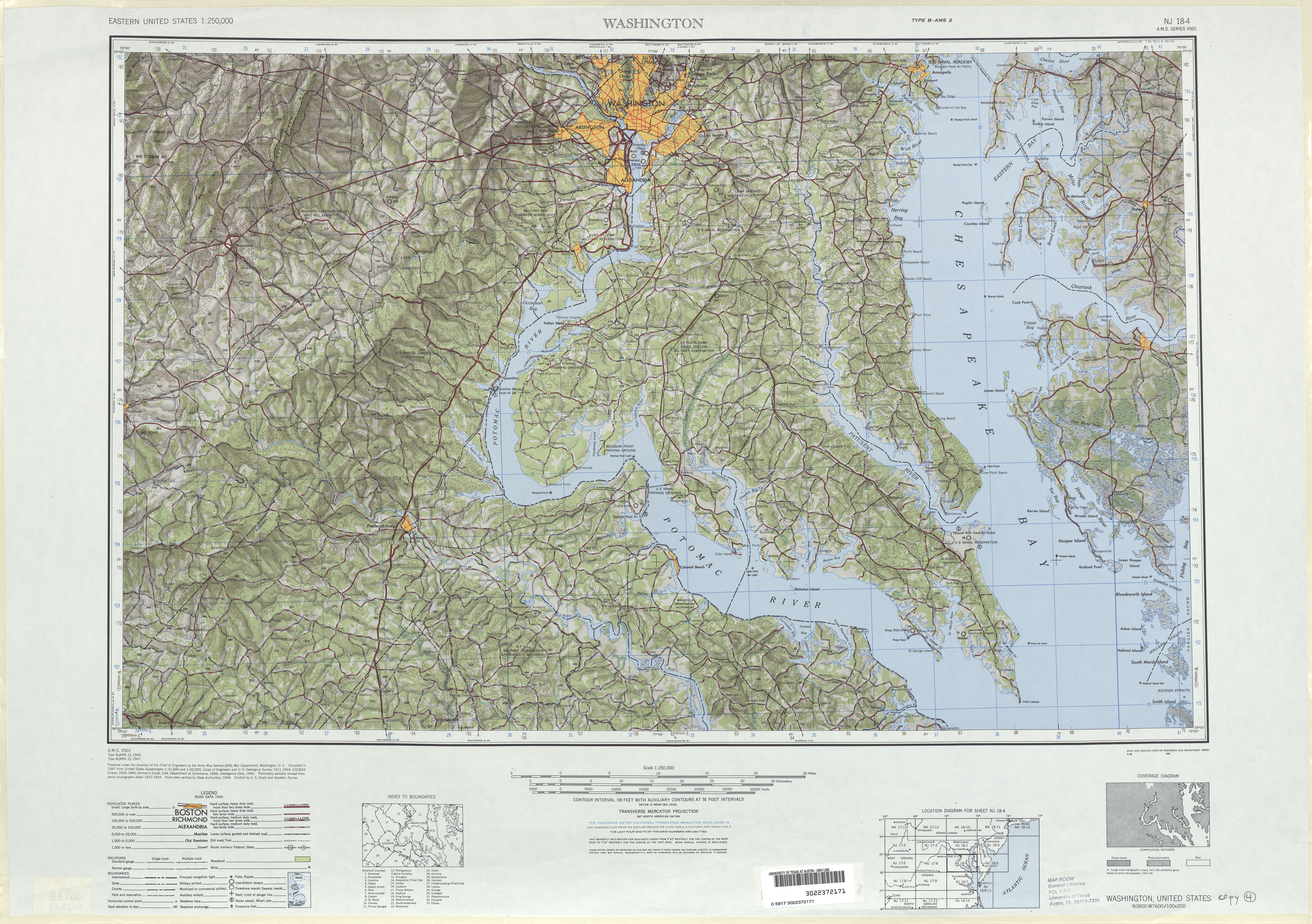
| — | — | — | — | — | — | Continued into Washington, D.C. on Naylor Road, Good Hope Road, and 11th Street to District of Columbia Route 4 (Pennsylvania Avenue).[1] MD 5 was directed to follow Branch Avenue to the D.C. border and DC 5 was modified to follow Branch Avenue from the Maryland border to DC 4 (Pennsylvania Avenue), which it followed west to the White House, by 1946.[2][3] By 1960, DC 5 no longer existed.[4] | ||
| — | — | — | — | — | — | |||
| — | — | — | — | — | — | |||
| — | — | Anacostia Freeway (DC 295) / 11th Street Bridges (I-695) in Anacostia | Kenilworth Avenue Freeway (MD 201) near Capitol Heights, MD | — | — | Anacostia Freeway (north of the 11th Street Bridges), Kenilworth Avenue Freeway | ||
| — | — | — | — | — | — | |||
| — | — | — | — | — | — | |||
| — | — | — | — | — | — | Massachusetts Avenue | ||
| — | — | — | — | — | — | |||
| — | — | — | — | — | — | |||
| ||||||||
See also

References
- ↑ Map of Maryland (Map). Maryland State Highway Administration. 1940. Retrieved 2009-03-03.
- ↑ Washington, D.C. 1:250,000 quadrangle (Map). United States Geological Survey. 1946. Retrieved 2009-04-03.
- ↑ Map of Washington, D.C. (Map). Cartography by Rand McNally. Firestone. 1946.
- ↑ Map of Maryland (Map). Maryland State Highway Administration. 1960. Archived from the original on 2008-08-26. Retrieved 2009-03-03.