| SL. No. |
Description |
Location |
Address |
District |
Coordinates |
Image |
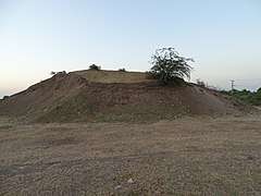
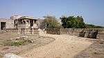
| N-GJ-66 |
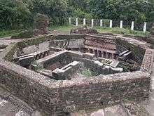
Ancient site Gohilwad Timbo (Mound) |
Amreli |
|
Amreli |
21°37′N 71°12′E / 21.61°N 71.20°E / 21.61; 71.20 (SL. No. N-GJ-66) |

More images |
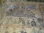
| N-GJ-67 |
Fresco on the wall of Kashiviswanath temple |
Padar Singha |
|
Amreli |
21°39′42″N 71°30′55″E / 21.661666°N 71.515140°E / 21.661666; 71.515140 (SL. No. N-GJ-67) |
More images |
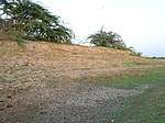
| N-GJ-68 |
Ancient Site |
Venivadar |
|
Amreli |
21°38′44″N 71°08′59″E / 21.645596°N 71.149663°E / 21.645596; 71.149663 (SL. No. N-GJ-68) |
More images |
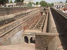
| N-GJ-69 |
Borsad Stepwell |
Borsad |
|
Anand |
22°24′40″N 72°54′04″E / 22.411107°N 72.901090°E / 22.411107; 72.901090 (SL. No. N-GJ-69) |
More images |
| N-GJ-70 |
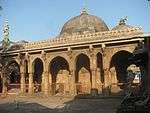
Jami Masjid, Khambhat |
Khambhat |
|
Anand |
22°18′36″N 72°37′04″E / 22.3100049°N 72.6178113°E / 22.3100049; 72.6178113 (SL. No. N-GJ-70) |
|
| N-GJ-71 |
Ancient site / Mound |
Sihor |
|
Bhavnagar |
21°42′22″N 71°57′54″E / 21.706065°N 71.964922°E / 21.706065; 71.964922 (SL. No. N-GJ-71) |
 |
| N-GJ-72 |
Darbargarh |
Sihor |
|
Bhavnagar |
21°42′39″N 71°58′00″E / 21.710895°N 71.966581°E / 21.710895; 71.966581 (SL. No. N-GJ-72) |
|
| N-GJ-73 |
Ancient site / Mound |
Vala (Vallabhi) |
|
Bhavnagar |
21°53′38″N 71°52′28″E / 21.893925°N 71.874324°E / 21.893925; 71.874324 (SL. No. N-GJ-73) |
|
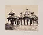
| N-GJ-74 |
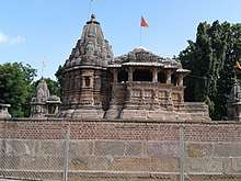
Jain temples |
Talaja |
|
Bhavnagar |
21°21′27″N 72°01′36″E / 21.3575458°N 72.0265713°E / 21.3575458; 72.0265713 (SL. No. N-GJ-74) |
More images |
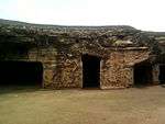
| N-GJ-75 |
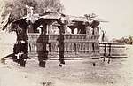
Talaja Caves |
Talaja |
|
Bhavnagar |
21°21′N 72°02′E / 21.35°N 72.03°E / 21.35; 72.03 (SL. No. N-GJ-75) |
More images |
| N-GJ-76 |
Jami Masjid |
Bharuch |
|
Bharuch |
21°41′31″N 72°58′55″E / 21.691854°N 72.982079°E / 21.691854; 72.982079 (SL. No. N-GJ-76) |
|
| N-GJ-77 |
Old Ruined temple of Mahadev |
Bavka |
|
Dahod |
22°45′08″N 74°12′04″E / 22.752239°N 74.201130°E / 22.752239; 74.201130 (SL. No. N-GJ-77) |
More images |
| N-GJ-78 |
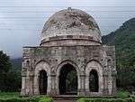
Tomb of Sikandar Shah |
Halol |
|
Godhra |
22°30′19″N 73°28′23″E / 22.5052553°N 73.4730718°E / 22.5052553; 73.4730718 (SL. No. N-GJ-78) |
|
| N-GJ-79 |
Ek-Minar-ki-Masjid |
Halol |
|
Godhra |
22°29′22″N 73°30′54″E / 22.489421°N 73.514995°E / 22.489421; 73.514995 (SL. No. N-GJ-79) |
More images |
| N-GJ-80 |
Panch-Mahuda-ki-Masjid |
Halol |
Sultanpura |
Godhra |
22°29′24″N 73°30′01″E / 22.4900964°N 73.5003195°E / 22.4900964; 73.5003195 (SL. No. N-GJ-80) |
More images |
| N-GJ-81 |
Tomb near Panch Mahuda Ki Masjid |
Halol |
Sultanpura |
Godhra |
22°29′39″N 73°30′01″E / 22.4941305°N 73.5001876°E / 22.4941305; 73.5001876 (SL. No. N-GJ-81) |
|
| N-GJ-82 |
Helical Stepped well (With 50 feet space around at pathway 10 feet wide to nearest road) |
Champaner |
|
Godhra |
22°29′04″N 73°30′56″E / 22.4844262°N 73.5155762°E / 22.4844262; 73.5155762 (SL. No. N-GJ-82) |
More images |
| N-GJ-83 |
Sakar Khan's Dargah |
Champaner |
|
Godhra |
22°28′58″N 73°31′06″E / 22.4827351°N 73.5183493°E / 22.4827351; 73.5183493 (SL. No. N-GJ-83) |
More images |
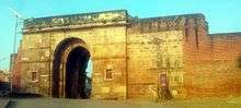
| N-GJ-84 |
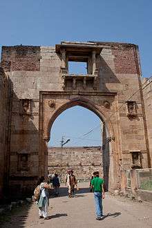
City Gate |
Champaner |
|
Godhra |
22°28′59″N 73°31′20″E / 22.483037°N 73.522240°E / 22.483037; 73.522240 (SL. No. N-GJ-84) |
|
| N-GJ-85 |
Citadel walls |
Champaner |
|
Godhra |
22°29′00″N 73°31′52″E / 22.483365°N 73.531211°E / 22.483365; 73.531211 (SL. No. N-GJ-85) |
|
| N-GJ-86 |
City walls at S.E. corner of the citadel going up the hill |
Champaner |
|
Godhra |
22°29′00″N 73°32′13″E / 22.483446°N 73.537005°E / 22.483446; 73.537005 (SL. No. N-GJ-86) |
|
| N-GJ-87 |
East and South Bhadra Gates 22°29′06″N 73°32′11″E / 22.484898°N 73.536494°E / 22.484898; 73.536494 |
Champaner |
|
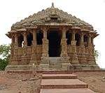
Godhra |
22°29′00″N 73°31′57″E / 22.483281°N 73.532506°E / 22.483281; 73.532506 (SL. No. N-GJ-87) |
|
| N-GJ-88 |
Sahar ki Masjid (Bohrani) |
Champaner |
|
Godhra |
22°29′01″N 73°31′46″E / 22.4836217°N 73.529406°E / 22.4836217; 73.529406 (SL. No. N-GJ-88) |
More images |
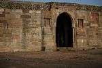
| N-GJ-89 |
Three cells |
Champaner |
|
Godhra |
22°29′04″N 73°31′52″E / 22.484362°N 73.5311885°E / 22.484362; 73.5311885 (SL. No. N-GJ-89) |
|
| N-GJ-90 |
Mandvi or Custom House |
Champaner |
|
Godhra |
22°29′03″N 73°31′54″E / 22.4842792°N 73.5317898°E / 22.4842792; 73.5317898 (SL. No. N-GJ-90) |
More images |
| N-GJ-91 |
Jami Masjid |
Champaner |
|
Godhra |
22°29′09″N 73°32′06″E / 22.4858869°N 73.534987°E / 22.4858869; 73.534987 (SL. No. N-GJ-91) |
More images |
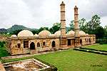
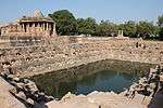
| N-GJ-92 |
Stepwell |
Champaner |
|
Godhra |
22°29′11″N 73°32′15″E / 22.486436°N 73.537614°E / 22.486436; 73.537614 (SL. No. N-GJ-92) |
|
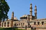
| N-GJ-93 |
Kevada Masjid |
Champaner |
|
Godhra |
22°29′22″N 73°31′53″E / 22.489371°N 73.531351°E / 22.489371; 73.531351 (SL. No. N-GJ-93) |
More images |
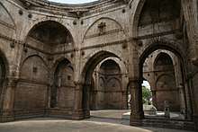
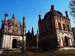
| N-GJ-94 |
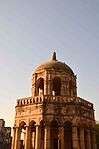
Tomb with a Brick dome in the centre and small corner domes (Bada Talb ka Maqbara) |
Champaner |
|
Godhra |
22°29′41″N 73°33′01″E / 22.494590°N 73.550385°E / 22.494590; 73.550385 (SL. No. N-GJ-94) |
|
| N-GJ-95 |
Canatoph of Kevda Masjid |
Champaner |
|
Godhra |
22°29′26″N 73°32′03″E / 22.4904503°N 73.5342606°E / 22.4904503; 73.5342606 (SL. No. N-GJ-95) |
|
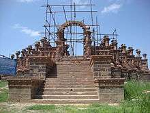
| N-GJ-96 |
Nagina Masjid |
Champaner |
|
Godhra |
22°29′39″N 73°31′45″E / 22.4941482°N 73.5290356°E / 22.4941482; 73.5290356 (SL. No. N-GJ-96) |
More images |
| N-GJ-97 |
Cenatop of Nagina Masjid |
Champaner |
|
Godhra |
22°29′39″N 73°31′49″E / 22.494281°N 73.530168°E / 22.494281; 73.530168 (SL. No. N-GJ-97) |
|
| N-GJ-98 |
Lila Gumbaj ki Masjid |
Champaner |
|
Godhra |
22°29′22″N 73°32′29″E / 22.4895358°N 73.5414171°E / 22.4895358; 73.5414171 (SL. No. N-GJ-98) |
More images |
| N-GJ-99 |
Kabutarkhana Pavilion (Khajuri Masjid) |
Champaner |
|
Godhra |
22°29′39″N 73°33′22″E / 22.4941263°N 73.556136°E / 22.4941263; 73.556136 (SL. No. N-GJ-99) |
More images |
| N-GJ-100 |
Kamani Masjid |
Champaner |
|
Godhra |
22°28′59″N 73°32′42″E / 22.4829944°N 73.5449283°E / 22.4829944; 73.5449283 (SL. No. N-GJ-100) |
More images |
| N-GJ-101 |
Bawa Man's Mosque |
Champaner |
|
Godhra |
22°28′45″N 73°32′01″E / 22.4792065°N 73.5335755°E / 22.4792065; 73.5335755 (SL. No. N-GJ-101) |
More images |
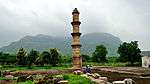
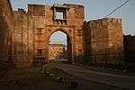
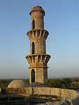
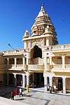
| N-GJ-102 |
Gate No. 1 Atak Gate (with two gateways) |
Pavagad hill |
|
Godhra |
22°28′35″N 73°31′51″E / 22.4764002°N 73.530729°E / 22.4764002; 73.530729 (SL. No. N-GJ-102) |
|
| N-GJ-103 |
Gate No. 2 (with three gateways) Budhiya gate |
Pavagad hill |
|
Godhra |
22°27′55″N 73°31′19″E / 22.465155°N 73.521968°E / 22.465155; 73.521968 (SL. No. N-GJ-103) |
|
| N-GJ-104 |
Gate No. 3 Moti gate Sadanshah-Gate |
Pavagad hill |
|
Godhra |
22°27′41″N 73°31′40″E / 22.461318°N 73.527644°E / 22.461318; 73.527644 (SL. No. N-GJ-104) |
|
| N-GJ-105 |
Gate No. 4 with big bastion with cells in the interior. |
Pavagad hill |
|
Godhra |
22°28′03″N 73°30′55″E / 22.467550°N 73.515280°E / 22.467550; 73.515280 (SL. No. N-GJ-105) |
|
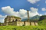
| N-GJ-106 |
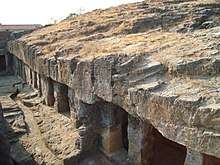
Sat Manzil with steps right up to bastions |
Pavagad hill |
|
Godhra |
22°27′44″N 73°30′59″E / 22.462290°N 73.516405°E / 22.462290; 73.516405 (SL. No. N-GJ-106) |
More images |
| N-GJ-107 |
Mint above Gate No. 4 |
Pavagad hill |
|
Godhra |
22°28′14″N 73°31′26″E / 22.470559°N 73.523902°E / 22.470559; 73.523902 (SL. No. N-GJ-107) |
|
| N-GJ-108 |
Gate No. 5 Gulan Bulan Gate |
Pavagad hill |
|
Godhra |
22°28′05″N 73°31′24″E / 22.467980°N 73.523371°E / 22.467980; 73.523371 (SL. No. N-GJ-108) |
|
| N-GJ-109 |
Gate No. 6 Buland Darwaja |
Pavagad hill |
|
Godhra |
22°27′55″N 73°31′14″E / 22.4651918°N 73.520613°E / 22.4651918; 73.520613 (SL. No. N-GJ-109) |
|
| N-GJ-110 |
Makai Kothar |
Pavagad hill |
|
Godhra |
22°27′55″N 73°31′14″E / 22.4651918°N 73.520613°E / 22.4651918; 73.520613 (SL. No. N-GJ-110) |
|
| N-GJ-111 |
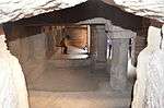
Patai Rawal's Palace with tanks |
Pavagad hill |
|
Godhra |
22°27′42″N 73°31′39″E / 22.461641°N 73.527433°E / 22.461641; 73.527433 (SL. No. N-GJ-111) |
|
| N-GJ-112 |
Gate No. 7 Makai Gate |
Pavagad hill |
|
Godhra |
22°27′56″N 73°31′10″E / 22.465579°N 73.519484°E / 22.465579; 73.519484 (SL. No. N-GJ-112) |
|
| N-GJ-113 |
Gate No. 8 Tarapore Gate |
Pavagad hill |
|
Godhra |
22°28′03″N 73°30′56″E / 22.467614°N 73.515446°E / 22.467614; 73.515446 (SL. No. N-GJ-113) |
|
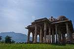
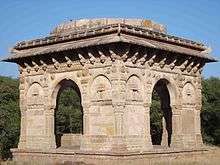
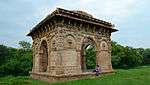
| N-GJ-114 |
Fort of Pavagad & ruined Hindu temples & Jain temples on the top of Pavagad hills |
Pavagad hill |
|
Godhra |
22°28′01″N 73°30′55″E / 22.466935°N 73.515211°E / 22.466935; 73.515211 (SL. No. N-GJ-114) |
|
| N-GJ-115 |
Navlakha Kothar |
Pavagad hill |
|
Godhra |
22°28′02″N 73°30′34″E / 22.4672932°N 73.5093394°E / 22.4672932; 73.5093394 (SL. No. N-GJ-115) |
|
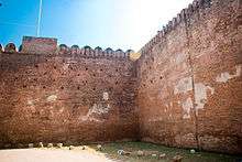
| N-GJ-116 |
Walls of fort on top |
Pavagad hill |
|
Godhra |
22°27′49″N 73°31′06″E / 22.463731°N 73.518443°E / 22.463731; 73.518443 (SL. No. N-GJ-116) |
|
| N-GJ-117 |
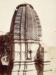
Rudra Mahalaya temple |
Desar |
|
Godhra |
22°21′02″N 73°33′07″E / 22.350548°N 73.551809°E / 22.350548; 73.551809 (SL. No. N-GJ-117) |
|
| N-GJ-118 |
Kankeshvara Mahadev temple |
Kakanpur |
|
Godhra |
22°49′56″N 73°29′03″E / 22.832235°N 73.484184°E / 22.832235; 73.484184 (SL. No. N-GJ-118) |
|
| N-GJ-119 |
Ratnesvara Old temple with sculptures screen |
Ratanpur |
|
Godhra |
22°50′22″N 73°25′55″E / 22.839493°N 73.432039°E / 22.839493; 73.432039 (SL. No. N-GJ-119) |
|
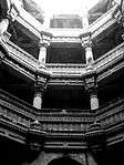
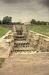
| N-GJ-120 |
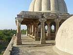
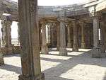
Rudabai stepwell or Adalaj Stepwell |
Adalaj |
|
Gandhinagar |
23°10′N 72°35′E / 23.17°N 72.58°E / 23.17; 72.58 (SL. No. N-GJ-120) |
More images |
| N-GJ-121 |
Durvasa Rishi's Ashram & its site (Pindara Group of Temples) |
Pindara |
|
Devbhoomi Dwarka |
22°15′52″N 69°15′10″E / 22.264560°N 69.252885°E / 22.264560; 69.252885 (SL. No. N-GJ-121) |
More images |
| N-GJ-122 |
Kalika Mata Temple |
Old Dhrewad |
|
Jamnagar |
22°08′58″N 69°04′22″E / 22.149327°N 69.072777°E / 22.149327; 69.072777 (SL. No. N-GJ-122) |
More images |
| N-GJ-123 |
Gokeshwara Mahadev temple |
Lowrali |
|
Jamnagar |
22°10′26″N 69°05′31″E / 22.173861°N 69.092041°E / 22.173861; 69.092041 (SL. No. N-GJ-123) |
|
| N-GJ-124 |
Gandhi fortress & temple in Survey no.106 |
Old Dhink |
|
Jamnagar |
22°12′28″N 69°04′49″E / 22.207823°N 69.080167°E / 22.207823; 69.080167 (SL. No. N-GJ-124) |
|
| N-GJ-125 |
Temples of Rama Lakshamana |
Baradia |
|
Jamnagar |
22°11′44″N 69°01′09″E / 22.195457°N 69.019040°E / 22.195457; 69.019040 (SL. No. N-GJ-125) |
More images |
| N-GJ-126 |
Dwarkadhish Group of Temples with its outer compounds SNO. 1607, 1608, 1609. |
Dwarka |
|
Jamnagar |
22°14′17″N 68°58′02″E / 22.237947°N 68.967259°E / 22.237947; 68.967259 (SL. No. N-GJ-126) |
More images |
| N-GJ-127 |
Kshatrapa Inscriptions |
Dwarka |
|
Jamnagar |
22°14′N 68°58′E / 22.24°N 68.96°E / 22.24; 68.96 (SL. No. N-GJ-127) |
|
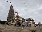
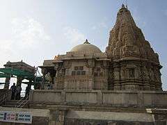
| N-GJ-128 |
Rukmini Devi Temple |
Dwarka |
|
Jamnagar |
22°15′27″N 68°57′52″E / 22.25739°N 68.964408°E / 22.25739; 68.964408 (SL. No. N-GJ-128) |
More images |
| N-GJ-129 |
Dhrasanvel Temple (Magderu) |
Dhrasanvel |
|
Devbhoomi Dwarka |
22°17′21″N 69°03′05″E / 22.289094°N 69.051486°E / 22.289094; 69.051486 (SL. No. N-GJ-129) |
More images |
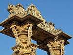
| N-GJ-130 |
Guhaditya temple in S.No. 655 |
Varvada |
|
Jamnagar |
22°18′04″N 68°59′13″E / 22.301028°N 68.986983°E / 22.301028; 68.986983 (SL. No. N-GJ-130) |
|
| N-GJ-131 |
Junagadhi (Jain) Temple |
Vasai |
|
Jamnagar |
22°19′05″N 68°59′57″E / 22.318005°N 68.999070°E / 22.318005; 68.999070 (SL. No. N-GJ-131) |
|
| N-GJ-132 |
Kankeshvara Mahadeva temple & other shrines |
Vasai |
|
Jamnagar |
22°19′06″N 68°59′50″E / 22.318453°N 68.997347°E / 22.318453; 68.997347 (SL. No. N-GJ-132) |
|
| N-GJ-133 |
Gop Temple |
Nani Gop |
|
Jamnagar |
22°01′43″N 69°55′44″E / 22.028611°N 69.928889°E / 22.028611; 69.928889 (SL. No. N-GJ-133) |
More images |
| N-GJ-134 |
Ashokan Rock (Edicts) |
Junagadh |
|
Junagadh |
21°31′33″N 70°28′59″E / 21.5259246°N 70.4830738°E / 21.5259246; 70.4830738 (SL. No. N-GJ-134) |
More images |
| N-GJ-135 |
Uparkot Caves (Buddhist Cave) of Junagadh Buddhist Cave Groups |
Junagadh |
|
Junagadh |
21°31′33″N 70°28′09″E / 21.5258065°N 70.4692958°E / 21.5258065; 70.4692958 (SL. No. N-GJ-135) |
More images |
| N-GJ-136 |
Baba Pyare and Khapra Kodia caves of Junagadh Buddhist Cave Groups |
Junagadh |
|
Junagadh |
21°31′12″N 70°28′05″E / 21.5198929°N 70.4679251°E / 21.5198929; 70.4679251 (SL. No. N-GJ-136) |
More images |
| N-GJ-137 |
Ancient Mound |
Intwa |
|
Junagadh |
21°33′06″N 70°29′30″E / 21.551755°N 70.491552°E / 21.551755; 70.491552 (SL. No. N-GJ-137) |
More images |
| N-GJ-138 |
Jami Masjid |
Mangrol |
|
Junagadh |
21°07′10″N 70°06′38″E / 21.119481°N 70.110520°E / 21.119481; 70.110520 (SL. No. N-GJ-138) |
|
| N-GJ-139 |
Bibi Masjid |
Mangrol |
|
Junagadh |
21°07′18″N 70°06′52″E / 21.121772°N 70.114375°E / 21.121772; 70.114375 (SL. No. N-GJ-139) |
|
| N-GJ-140 |
Raveli Masjid |
Mangrol |
|
Junagadh |
21°07′18″N 70°06′46″E / 21.1217042°N 70.1126652°E / 21.1217042; 70.1126652 (SL. No. N-GJ-140) |
|
| N-GJ-141 |
Ranchhod Rayaji Temple with wasterland around the chowk of Mahadeva Temple |
Mul Dwarka |
|
Junagadh |
20°45′34″N 70°39′40″E / 20.759359°N 70.661215°E / 20.759359; 70.661215 (SL. No. N-GJ-141) |
More images |
| N-GJ-142 |
Vithalbhai Haveli |
Vasco |
|
Kheda |
22°39′40″N 72°45′21″E / 22.661005°N 72.755834°E / 22.661005; 72.755834 (SL. No. N-GJ-142) |
|
| N-GJ-143 |
Bhamaria Well |
Mahamadabad |
|
Kheda |
22°48′42″N 72°44′57″E / 22.811785°N 72.749130°E / 22.811785; 72.749130 (SL. No. N-GJ-143) |
|
| N-GJ-144 |
Temple of Galteshwar |
Sarnal |
|
Kheda |
22°47′06″N 73°16′39″E / 22.7850416°N 73.2774858°E / 22.7850416; 73.2774858 (SL. No. N-GJ-144) |
More images |
| N-GJ-145 |
Tomb of Saif-ud-din & Nizam-ud-din |
Sojali |
|
Kheda |
22°50′30″N 72°46′20″E / 22.841648°N 72.772095°E / 22.841648; 72.772095 (SL. No. N-GJ-145) |
|
| N-GJ-146 |
Tomb of Mubarak Saiyyad (Roza Rozi Dargah Sharif) |
Sojali |
|
Kheda |
22°50′33″N 72°46′20″E / 22.8423665°N 72.7722642°E / 22.8423665; 72.7722642 (SL. No. N-GJ-146) |
|
| N-GJ-147 |
Rao Lakhpatji Chhatri |
Bhuj |
|
Kachchh |
23°14′47″N 69°39′28″E / 23.2463574°N 69.6578659°E / 23.2463574; 69.6578659 (SL. No. N-GJ-147) |
More images |
| N-GJ-148 |
Siva temple |
Kotai |
|
Kachchh |
23°23′04″N 69°46′56″E / 23.384386°N 69.7823248°E / 23.384386; 69.7823248 (SL. No. N-GJ-148) |
|
| N-GJ-149 |
Excavated Site (Surkotada) |
Surkotada |
|
Kachchh |
23°53′12″N 70°12′24″E / 23.8866023°N 70.2067253°E / 23.8866023; 70.2067253 (SL. No. N-GJ-149) |
|
| N-GJ-150 |
Malai Mata temple |
Palodar |
|
Mehsana |
23°38′28″N 72°21′38″E / 23.64105°N 72.36051°E / 23.64105; 72.36051 (SL. No. N-GJ-150) |
More images |
| N-GJ-151 |
Hingloji Mata temple (Hinglaj Mata) |
Khandosan |
|
Mehsana |
23°44′14″N 72°28′23″E / 23.737163°N 72.4730599°E / 23.737163; 72.4730599 (SL. No. N-GJ-151) |
|
| N-GJ-152 |
Sabha Mandapa (Double Shrines) & the ancient shrines (Panchmukhi Mahadev temple) |
Khandosan |
|
Mehsana |
23°44′14″N 72°28′26″E / 23.7372111°N 72.4738752°E / 23.7372111; 72.4738752 (SL. No. N-GJ-152) |
|
| N-GJ-153 |
Jasmalnathji Mahadev Temple (Vaijnath Mahadev temple) |
Asoda |
|
Mehsana |
23°35′00″N 72°35′23″E / 23.5834173°N 72.5898466°E / 23.5834173; 72.5898466 (SL. No. N-GJ-153) |
More images |
| N-GJ-154 |
Ajpal Kund (Gauri Kund) |
Vadnagar |
|
Mehsana |
23°46′58″N 72°38′54″E / 23.782840°N 72.648402°E / 23.782840; 72.648402 (SL. No. N-GJ-154) |
|
| N-GJ-155 |
Inscription and Arjun Bari Gate |
Vadnagar |
|
Mehsana |
23°47′18″N 72°38′21″E / 23.788411°N 72.639203°E / 23.788411; 72.639203 (SL. No. N-GJ-155) |
More images |
| N-GJ-156 |
Kirti Toran |
Vadnagar |
|
Mehsana |
23°47′27″N 72°38′32″E / 23.790706°N 72.642108°E / 23.790706; 72.642108 (SL. No. N-GJ-156) |
More images |
| N-GJ-157 |
Kund |
Vijapur |
|
Mehsana |
23°33′52″N 72°45′27″E / 23.564427°N 72.757434°E / 23.564427; 72.757434 (SL. No. N-GJ-157) |
|
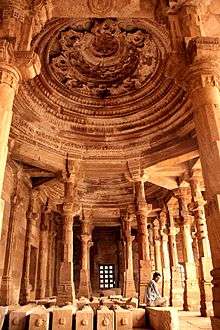
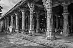
| N-GJ-158 |
Sun temple, Surya kund with adjoining other temples and loose sculptures |
Modhera |
|
Mehsana |
23°35′02″N 72°07′58″E / 23.583806°N 72.132686°E / 23.583806; 72.132686 (SL. No. N-GJ-158) |
More images |
| N-GJ-159 |
Gateway of Khan Sarovar |
Patan |
|
Patan |
23°50′22″N 72°06′55″E / 23.839311°N 72.115215°E / 23.839311; 72.115215 (SL. No. N-GJ-159) |
|
| N-GJ-160 |
Rani ki vav |
Patan |
|
Patan |
23°51′31″N 72°06′03″E / 23.8586213°N 72.1008259°E / 23.8586213; 72.1008259 (SL. No. N-GJ-160) |
More images |
| N-GJ-161 |
Sahastralinga Tank (Excavated) |
Anavada |
|
Patan |
23°51′45″N 72°05′52″E / 23.8623844°N 72.0976529°E / 23.8623844; 72.0976529 (SL. No. N-GJ-161) |
More images |
| N-GJ-162 |
Shaikh Farid Tomb |
Patan |
|
Patan |
23°51′59″N 72°05′47″E / 23.8663433°N 72.0963001°E / 23.8663433; 72.0963001 (SL. No. N-GJ-162) |
|
| N-GJ-163 |
Jami Masjid |
Sidhpur |
|
Patan |
23°55′10″N 72°22′44″E / 23.919401°N 72.378996°E / 23.919401; 72.378996 (SL. No. N-GJ-163) |
|
| N-GJ-164 |
Ruins of Rudra Mahalaya Temple, Sidhpur |
Sidhpur |
|
Patan |
23°55′10″N 72°22′37″E / 23.9193298°N 72.3769266°E / 23.9193298; 72.3769266 (SL. No. N-GJ-164) |
More images |
| N-GJ-165 |
Nilkantheswar Mahadev temple |
Sunak |
|
Patan |
23°48′10″N 72°19′03″E / 23.8026825°N 72.3175234°E / 23.8026825; 72.3175234 (SL. No. N-GJ-165) |
|
| N-GJ-166 |
Sivai Mata temple |
Sunak |
|
Patan |
23°48′11″N 72°18′59″E / 23.8029434°N 72.3163822°E / 23.8029434; 72.3163822 (SL. No. N-GJ-166) |
|
| N-GJ-167 |
Nilkantheswar Mahadev temple |
Ruhavi |
|
Patan |
23°46′09″N 72°18′02″E / 23.769284°N 72.300576°E / 23.769284; 72.300576 (SL. No. N-GJ-167) |
|
| N-GJ-168 |
Two small shrines Sanderi Mata temple |
Sander |
|
Patan |
23°46′04″N 72°15′33″E / 23.767870°N 72.259281°E / 23.767870; 72.259281 (SL. No. N-GJ-168) |
|
| N-GJ-169 |
Sitamata temple |
Piludra |
|
Patan |
23°39′54″N 72°25′55″E / 23.664928°N 72.431899°E / 23.664928; 72.431899 (SL. No. N-GJ-169) |
|
| N-GJ-170 |
Torana with a Sun image |
Piludra |
|
Patan |
23°39′50″N 72°25′54″E / 23.663910°N 72.431544°E / 23.663910; 72.431544 (SL. No. N-GJ-170) |
|
| N-GJ-171 |
Limboji Mata temple |
Delmal |
|
Patan |
23°38′35″N 71°59′31″E / 23.6430806°N 71.9920321°E / 23.6430806; 71.9920321 (SL. No. N-GJ-171) |
|
| N-GJ-172 |
Kirti Mandir, Porbandar (House where Mahatma Gandhi was born) |
Porbandar |
|
Porbandar |
21°38′28″N 69°36′02″E / 21.641111°N 69.600556°E / 21.641111; 69.600556 (SL. No. N-GJ-172) |
|
| N-GJ-173 |
Old Parsvanath temple |
Miyani |
|
Porbandar |
21°50′23″N 69°22′56″E / 21.839603°N 69.382297°E / 21.839603; 69.382297 (SL. No. N-GJ-173) |
|
| N-GJ-174 |
Dhank Caves |
Dhank |
|
Rajkot |
21°50′02″N 70°04′59″E / 21.834°N 70.083°E / 21.834; 70.083 (SL. No. N-GJ-174) |
More images |
| N-GJ-175 |
Tomb of Sikandarshah |
Prantji |
|
Sabarkanta |
23°26′08″N 72°51′28″E / 23.435678°N 72.857663°E / 23.435678; 72.857663 (SL. No. N-GJ-175) |
|
| N-GJ-176 |
Roda Group of Temples |
Khed & Roda |
|
Sabarkanta |
23°39′33″N 73°04′59″E / 23.659032°N 73.083052°E / 23.659032; 73.083052 (SL. No. N-GJ-176) |
|
| N-GJ-177 |
Dargah known as Khawaja Dana Saheb's Rouza |
Surat |
|
Surat |
21°11′28″N 72°49′16″E / 21.1911917°N 72.8211006°E / 21.1911917; 72.8211006 (SL. No. N-GJ-177) |
|
| N-GJ-178 |
Old English Tombs |
Surat |
|
Surat |
21°12′39″N 72°49′33″E / 21.2109089°N 72.8258921°E / 21.2109089; 72.8258921 (SL. No. N-GJ-178) |
More images |
| N-GJ-179 |
Tomb of Khawaja Safar Sulemani (Khudawand Khan Rojo) |
Surat |
|
Surat |
21°12′15″N 72°49′25″E / 21.204222°N 72.823630°E / 21.204222; 72.823630 (SL. No. N-GJ-179) |
|
| N-GJ-180 |
Old Dutch & Armenian Tombs & Cemeteries |
Surat |
|
Surat |
21°12′35″N 72°49′35″E / 21.2096158°N 72.8263811°E / 21.2096158; 72.8263811 (SL. No. N-GJ-180) |
More images |
| N-GJ-181 |
Ancient site comprising S.Plot No.535 |
Kamrej |
|
Surat |
21°16′57″N 72°58′02″E / 21.282601°N 72.967180°E / 21.282601; 72.967180 (SL. No. N-GJ-181) |
|
| N-GJ-182 |
Fateh Burj |
Vyara |
|
Surat |
21°06′52″N 73°23′42″E / 21.114547°N 73.395040°E / 21.114547; 73.395040 (SL. No. N-GJ-182) |
|
| N-GJ-183 |
Ranak Devi's Temple |
Wadhwan |
|
Surendranagar |
22°42′49″N 71°40′34″E / 22.7136058°N 71.6760174°E / 22.7136058; 71.6760174 (SL. No. N-GJ-183) |
More images |
| N-GJ-184 |
Ancient Mound (Rangpur, India) |
Rangpur |
|
Surendranagar |
22°24′02″N 71°55′43″E / 22.400623°N 71.928740°E / 22.400623; 71.928740 (SL. No. N-GJ-184) |
|
| N-GJ-185 |
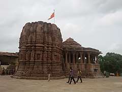
Sun Temple |
Thangadh |
|
Surendranagar |
22°35′50″N 71°12′53″E / 22.597305°N 71.214803°E / 22.597305; 71.214803 (SL. No. N-GJ-185) |
|
| N-GJ-186 |
Navlakha temple |
Sejakpur |
|
Surendranagar |
22°27′26″N 71°24′45″E / 22.4572546°N 71.4124424°E / 22.4572546; 71.4124424 (SL. No. N-GJ-186) |
|
| N-GJ-187 |
Ancient Site/Mound (Ganesh temple) in village |
Sejakpur |
|
Surendranagar |
22°27′25″N 71°24′52″E / 22.456888°N 71.414446°E / 22.456888; 71.414446 (SL. No. N-GJ-187) |
|
| N-GJ-188 |
Darbargarh |
Halwad |
|
Surendranagar |
23°00′42″N 71°10′43″E / 23.011568°N 71.178670°E / 23.011568; 71.178670 (SL. No. N-GJ-188) |
|
| N-GJ-189 |
Ananteshwara temple |
Bhadia Anandpur |
|
Surendranagar |
22°13′28″N 71°10′03″E / 22.2245196°N 71.1675705°E / 22.2245196; 71.1675705 (SL. No. N-GJ-189) |
|
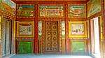
| N-GJ-190 |
Fresco Rooms in Bhau Tambekar's Wada |
Vadodara |
|
Vadodara |
22°18′10″N 73°11′49″E / 22.3027654°N 73.1969569°E / 22.3027654; 73.1969569 (SL. No. N-GJ-190) |
More images |
| N-GJ-191 |
Historic Site S.No. 431,435 |
Vadodara |
|
Vadodara |
22°18′03″N 73°10′52″E / 22.3008275°N 73.1812277°E / 22.3008275; 73.1812277 (SL. No. N-GJ-191) |
|
| N-GJ-192 |
Hazira or Qutbuddin Mahmad Khan's Tomb (Hazira Maqbara) |
Danteshwar |
|
Vadodara |
22°16′41″N 73°12′24″E / 22.2780622°N 73.206665°E / 22.2780622; 73.206665 (SL. No. N-GJ-192) |
More images |
| N-GJ-193 |
Ancient Site (Excavated) at Kayavarohan |
Kayavarohan |
|
Vadodara |
22°04′52″N 73°14′59″E / 22.081067°N 73.249753°E / 22.081067; 73.249753 (SL. No. N-GJ-193) |
More images |
| N-GJ-194 |
Gateway of Torana |
Kayavarohan |
|
Vadodara |
22°04′57″N 73°14′52″E / 22.082522°N 73.247791°E / 22.082522; 73.247791 (SL. No. N-GJ-194) |
More images |
| N-GJ-195 |
Ancient site of Sandhiyapura |
Goraj |
|
Vadodara |
22°19′54″N 73°28′35″E / 22.331658°N 73.476331°E / 22.331658; 73.476331 (SL. No. N-GJ-195) |
|
| N-GJ-196 |
Vadodara Gate & its adjacent construction |
Dabhoi |
|
Vadodara |
22°08′04″N 73°24′56″E / 22.1344384°N 73.4155705°E / 22.1344384; 73.4155705 (SL. No. N-GJ-196) |
More images |
| N-GJ-197 |
Hira Gate with S.No. 38, 41, 45, 47 & Ticca No. 102&103. |
Dabhoi |
|
Vadodara |
22°08′01″N 73°25′28″E / 22.1334856°N 73.4244579°E / 22.1334856; 73.4244579 (SL. No. N-GJ-197) |
More images |
| N-GJ-198 |
Mahudi (Champaneri) Gate & adjacent construction |
Dabhoi |
|
Vadodara |
22°08′16″N 73°25′07″E / 22.1377771°N 73.4184886°E / 22.1377771; 73.4184886 (SL. No. N-GJ-198) |
|
| N-GJ-199 |
Nandodi Gate with adjacent construction |
Dabhoi |
|
Vadodara |
22°07′47″N 73°25′13″E / 22.1297718°N 73.4203904°E / 22.1297718; 73.4203904 (SL. No. N-GJ-199) |
More images |
| N-GJ-200 |
Saptamukhi Vav |
Dabhoi |
|
Vadodara |
22°08′07″N 73°25′19″E / 22.135293°N 73.421896°E / 22.135293; 73.421896 (SL. No. N-GJ-200) |
|
| N-GJ-201 |
Microlithic site S.No. 311,12,13 & 298 |
Amarjpura |
|
Vadodara |
22°40′36″N 73°16′17″E / 22.676663°N 73.271515°E / 22.676663; 73.271515 (SL. No. N-GJ-201) |
|
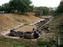
| N-GJ-202 |
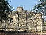
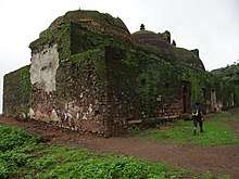
Dholavira (Ancient Site (Kotada)) |
Dholavira |
Bhachau Taluka |
Kutch |
23°53′10″N 70°13′00″E / 23.886111°N 70.216667°E / 23.886111; 70.216667 (SL. No. N-GJ-202) |
More images |

.JPG)
_Palace%2C_Pavagadh.JPG)
.jpg)

_of_Malai_Mata_temple%2C_Palodar%2C_Gujarat%2C_India.jpg)

_(9).jpg)