Lisboa Island (Guinea-Bissau)
 Lisboa Island Location | |
| Geography | |
|---|---|
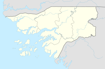
| Location | Mansoa River |
| Coordinates | 11°59′00″N 15°52′00″W / 11.9833°N 15.8667°WCoordinates: 11°59′00″N 15°52′00″W / 11.9833°N 15.8667°W |
| Length | 9.5 km (5.9 mi) |
| Width | 1.9 km (1.18 mi) |
| Highest elevation | 9 m (30 ft) |
| Administration | |
| Region | Cacheu Region |
| Sector | Caió |
Lisboa Island (Portuguese: Ilha de Lisboa) is an island in Guinea-Bissau. It is located in the Mansoa River, just east of the confluence with the Baboque River. Its maximum elevation is 9 m.[1]
See also
References
External links
This article is issued from
Wikipedia.
The text is licensed under Creative Commons - Attribution - Sharealike.
Additional terms may apply for the media files.