Lindequesdrif
| Lindequesdrif | |
|---|---|
 Lindequesdrif  Lindequesdrif Lindequesdrif (South Africa)  Lindequesdrif Lindequesdrif (Africa) | |
| Coordinates: 26°45′26″S 27°34′04″E / 26.7572°S 27.5677°ECoordinates: 26°45′26″S 27°34′04″E / 26.7572°S 27.5677°E | |
| Country | South Africa |
| Province | North West |
| District | Dr Kenneth Kaunda |
| Municipality | Tlokwe |
| Area[1] | |
| • Total | 18.04 km2 (6.97 sq mi) |
| Population (2011)[1] | |
| • Total | 1,147 |
| • Density | 64/km2 (160/sq mi) |
| Racial makeup (2011)[1] | |
| • Black African | 50.7% |
| • Coloured | 5.1% |
| • White | 43.4% |
| • Other | 0.8% |
| First languages (2011)[1] | |
| • Afrikaans | 44.8% |
| • Sotho | 24.8% |
| • Tswana | 8.0% |
| • Xhosa | 7.9% |
| • Other | 14.5% |
| Time zone | UTC+2 (SAST) |
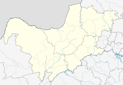
Lindequesdrif is an area comprising agricultural holdings, lying between Vanderbijlpark and Potchefstroom, in the far eastern corner of North West province in South Africa.
It lies on the northern banks of the Vaal River near Sasolburg on the border with the Free State.
References
- 1 2 3 4 "Main Place Lindequesdrif". Census 2011.
This article is issued from
Wikipedia.
The text is licensed under Creative Commons - Attribution - Sharealike.
Additional terms may apply for the media files.
.svg.png)