Liberty Township, Bollinger County, Missouri
| Liberty Township | |
|---|---|
| Township | |
 | |
| Coordinates: 37°11′45″N 089°57′53″W / 37.19583°N 89.96472°WCoordinates: 37°11′45″N 089°57′53″W / 37.19583°N 89.96472°W | |
| Country | United States |
| State | Missouri |
| County | Bollinger |
| Area | |
| • Total | 91.51 sq mi (237.02 km2) |
| • Land | 91.43 sq mi (236.8 km2) |
| • Water | 0.09 sq mi (0.22 km2) 0.09% |
| Elevation[1] | 449 ft (137 m) |
| Population (2010) | |
| • Total | 1,371 |
| • Density | 24.11/sq mi (14.98/km2) |
| FIPS code | 29-41960[2] |
| GNIS feature ID | 0766323 |
Liberty Township is one of eight townships in Bollinger County, Missouri, USA.[3] As of the 2000 U.S. Census, its population was 1,224. As of the 2010 U.S. Census, its population had increased to 1,371. Liberty Township covers an area of 91.51 square miles (237.0 km2).
Demographics
As of the 2010 U.S. Census, there were 1,371 people residing in the township. The population density was 14.98 people per square mile (24.11/km²). There were 627 housing units in the township. The racial makeup of the township was 98.61% White, 0.51% Native American, 0.07% Asian, 0.22% from other races, and 0.58% from two or more races. Approximately 0.51% of the population were Hispanic or Latino of any race.
Geography
Incorporated Areas
The township contains no incorporated settlements.
Unincorporated Areas
The township contains the unincorporated areas and historical communities of Dongola, Drum, Glennon, Hahn, Sank, and Schlatitz.
Cemeteries
The township contains the following six cemeteries: Cane Creek, Crites, Frazier, Kellion, Mansion, and Mansker.
Streams
The streams of Cane Creek, Clubb Creek, Dry Creek, Gizzard Creek, Hawker Creek, Malone Creek, Perkins Creek, and Virgin Creek flow through Liberty Township. Other bodies of water located in the township include the Diversion Headwater Channel, Virgin Creek Lake, and Whippoorwill Lake.
Landmarks
- Clubb Creek Conservation Area
- Sank Conservation Area
- Whippoorwill Lake Family Campground
Administrative Districts
School Districts
- Advance R-IV School District
- Delta R-V School District
- Leopold R-III School District
- Woodland R-IV School District
- Zalma R-V School District
Political Districts
- Missouri's 8th Congressional District
- State House District 145
- State Senate District 27
References
- ↑ "US Board on Geographic Names". United States Geological Survey. 2007-10-25. Retrieved 2008-01-31.
- ↑ "American FactFinder". United States Census Bureau. Archived from the original on September 11, 2013. Retrieved 2008-01-31.
- ↑ http://www.city-data.com/township/Liberty-Bollinger-MO.html
External links
Municipalities and communities of Bollinger County, Missouri, United States | ||
|---|---|---|
| City | 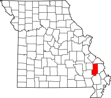 | |
| Villages | ||
| Townships | ||
| Unincorporated communities | ||
| Abandoned villages | ||