Levert, Alabama
| Levert, Alabama | |
|---|---|
| Unincorporated community | |
 Levert, Alabama  Levert, Alabama | |
| Coordinates: 32°45′33″N 87°14′29″W / 32.75917°N 87.24139°WCoordinates: 32°45′33″N 87°14′29″W / 32.75917°N 87.24139°W | |
| Country | United States |
| State | Alabama |
| County | Perry |
| Elevation | 180 ft (50 m) |
| Time zone | UTC-6 (Central (CST)) |
| • Summer (DST) | UTC-5 (CDT) |
| Area code(s) | 334 |
| GNIS feature ID | 159927[1] |
Levert, also spelled Le Vert, is an unincorporated community in Perry County, Alabama, United States. Levert lies entirely within the Oakmulgee District of the Talladega National Forest. A post office operated under the name Le Vert from 1881 to 1905.[2]
References
- ↑ "Levert". Geographic Names Information System. United States Geological Survey.
- ↑ "Perry County". Jim Forte Postal History. Retrieved 26 August 2015.
Municipalities and communities of Perry County, Alabama, United States | ||
|---|---|---|
| Cities | 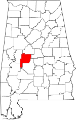 | |
| Unincorporated communities | ||
This article is issued from
Wikipedia.
The text is licensed under Creative Commons - Attribution - Sharealike.
Additional terms may apply for the media files.