Les Diablons
| Les Diablons | |
|---|---|
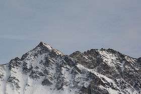 View of Les Diablons from above Zinal | |
| Highest point | |
| Elevation | 3,609 m (11,841 ft) |
| Prominence | 379 m (1,243 ft) [1] |
| Coordinates | 46°8′32.8″N 7°40′15.7″E / 46.142444°N 7.671028°ECoordinates: 46°8′32.8″N 7°40′15.7″E / 46.142444°N 7.671028°E |
| Geography | |
 Les Diablons Location in Switzerland | |
| Location | Valais, Switzerland |
| Parent range | Pennine Alps |
Les Diablons are a mountain of the Swiss Pennine Alps, overlooking Zinal in the canton of Valais. They lie between the valleys of Anniviers and Turtmann on the subrange of the Pennine Alps that culminates at the Weisshorn.
South of Les Diablons, on the Tracuit pass, is located the Tracuit Hut.
See also
References
- ↑ Retrieved from the Swisstopo topographic maps and Google Earth. The key col is the Col de Tracuit (3,230 m).
External links
This article is issued from
Wikipedia.
The text is licensed under Creative Commons - Attribution - Sharealike.
Additional terms may apply for the media files.