Les Alleuds, Maine-et-Loire
| Les Alleuds | |
|---|---|
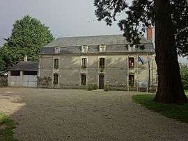 The town hall of Les Alleuds | |
 Les Alleuds Location within Pays de la Loire region  Les Alleuds | |
| Coordinates: 47°19′13″N 0°24′30″W / 47.3203°N 0.4083°WCoordinates: 47°19′13″N 0°24′30″W / 47.3203°N 0.4083°W | |
| Country | France |
| Region | Pays de la Loire |
| Department | Maine-et-Loire |
| Arrondissement | Angers |
| Canton | Les Ponts-de-Cé |
| Area1 | 10.47 km2 (4.04 sq mi) |
| Population (2009)2 | 891 |
| • Density | 85/km2 (220/sq mi) |
| Time zone | UTC+1 (CET) |
| • Summer (DST) | UTC+2 (CEST) |
| INSEE/Postal code | 49001 /49320 |
| Elevation |
49–73 m (161–240 ft) (avg. 69 m or 226 ft) |
|
1 French Land Register data, which excludes lakes, ponds, glaciers > 1 km2 (0.386 sq mi or 247 acres) and river estuaries. 2 Population without double counting: residents of multiple communes (e.g., students and military personnel) only counted once. | |
Les Alleuds is a former commune in the Maine-et-Loire department in western France. On 15 December 2016, it was merged into the new commune Brissac Loire Aubance.[1]
Population
| Historical population | ||
|---|---|---|
| Year | Pop. | ±% |
| 1793 | 480 | — |
| 1800 | 252 | −47.5% |
| 1806 | 464 | +84.1% |
| 1821 | 490 | +5.6% |
| 1831 | 541 | +10.4% |
| 1836 | 546 | +0.9% |
| 1841 | 557 | +2.0% |
| 1846 | 577 | +3.6% |
| 1851 | 581 | +0.7% |
| 1856 | 562 | −3.3% |
| 1861 | 586 | +4.3% |
| 1866 | 582 | −0.7% |
| 1872 | 580 | −0.3% |
| 1876 | 578 | −0.3% |
| 1881 | 530 | −8.3% |
| 1886 | 534 | +0.8% |
| 1891 | 528 | −1.1% |
| 1896 | 492 | −6.8% |
| 1901 | 512 | +4.1% |
| 1906 | 514 | +0.4% |
| 1911 | 506 | −1.6% |
| 1921 | 439 | −13.2% |
| 1926 | 474 | +8.0% |
| 1931 | 467 | −1.5% |
| 1936 | 468 | +0.2% |
| 1946 | 479 | +2.4% |
| 1954 | 443 | −7.5% |
| 1962 | 443 | +0.0% |
| 1968 | 431 | −2.7% |
| 1975 | 402 | −6.7% |
| 1982 | 449 | +11.7% |
| 1990 | 564 | +25.6% |
| 1999 | 636 | +12.8% |
| 2006 | 817 | +28.5% |
| 2009 | 891 | +9.1% |
See also
References
- ↑ Arrêté préfectoral 6 September 2016 (in French)
External links
| Wikimedia Commons has media related to Les Alleuds (Maine-et-Loire). |
This article is issued from
Wikipedia.
The text is licensed under Creative Commons - Attribution - Sharealike.
Additional terms may apply for the media files.