Lepallier River
| Lepallier | |
| River | |
| Country | Canada |
|---|---|
| Province | Quebec |
| Region | Nord-du-Québec |
| Tributaries | |
| - left | Louvart River |
| - right |
|
| Source | Lepallier Lake |
| - location | Eeyou Istchee Baie-James (municipalité), Nord-du-Québec, Jamésie, Quebec |
| - elevation | 190 m (623 ft) |
| - coordinates | 50°55′15″N 78°01′10″W / 50.92083°N 78.01944°W |
| Mouth | Broadback River |
| - location | Waskaganish (Cree village municipality), Nord-du-Québec, Jamésie, Quebec |
| - elevation | 8.0 m (26 ft) |
| - coordinates | 51°18′55″N 78°44′09″W / 51.31528°N 78.73583°WCoordinates: 51°18′55″N 78°44′09″W / 51.31528°N 78.73583°W |
| Length | 39.3 km (24.4 mi) [1] |
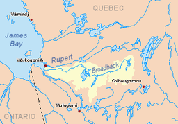 Watershed of Broadback River | |
The Lepallier River is a tributary of the south shore of the Broadback River flowing westward to Rupert Bay, located south of the James Bay. The Lepallier River flows in the municipalities of Eeyou Istchee Baie-James (municipality) and Waskaganish (Cree village municipality), in the administrative region of Nord-du-Québec, in Quebec, in Canada.
Geography
- north side: Broadback River;
- east side: Machisipi River, Natouacamisie River;
- south side: Nottaway River;
- west side: Nottaway River, Rupert Bay.
The Lepallier River flows northwest between the Nottaway (located to the south) and the Broadback River (located to the north).
This hydrographic slope originates from Rodayer Lake (length: 67 kilometres (42 mi); altitude: 250 metres (820 ft)), located at 10.4 kilometres (6.5 mi) north of the Nottaway River, at 14 kilometres (8.7 mi) north of Desorsons Lake (elevation: 254 metres (833 ft)) and west of Utamikaneu Lake (surrounded by marsh, altitude: 261 metres (856 ft)).
From Lepallier Lake, the Lepallier River flows over 39.3 kilometres (24.4 mi), first to the northwest, then to the north, collecting the waters of the Louvart River (coming from the South-East) and crossing several marsh areas. Its mouth flows to the south bank of the Broadback River, southeast of the Cree village of Waskaganish (Cree village municipality), at 9.4 kilometres (5.8 mi) upstream of the mouth of the latter river, at 6.5 kilometres (4.0 mi) downstream of the mouth of the Machisipi River and at 11.3 kilometres (7.0 mi) downstream of the mouth of the Natouacamisie River.
The Lepallier River is accessible from the Rodayer Lake campground, near the "James Bay Road". The Lepallier River is accessible from the Rodayer Lake Campground, near the "James Bay Road".Toponymy
The old name of this watercourse was "Coussinet river".
The toponym "Lepallier River" was formalized on December 5, 1968, at the Commission de toponymie du Québec.[2]
See also
- Rupert Bay
- James Bay
- Broadback River
- Nottaway River
- Natouacamisie River
- Louvart River
- Waskaganish (Cree village municipality), a northern village in the Cree commconverty
- Eeyou Istchee James Bay (municipality)
- Jamésie
- List of rivers of Quebec
References
- ↑ "Atlas of Canada". atlas.nrcan.gc.ca. Retrieved 2018-02-15.
- ↑ Commission de toponymie du Quebec - Bank of Place Names - Toponym: "Lepallier River".