Lenzerhorn
| Lenzerhorn | |
|---|---|
 | |
| Highest point | |
| Elevation | 2,906 m (9,534 ft) |
| Prominence | 291 m (955 ft) [1] |
| Isolation | 3.32 kilometres (2.06 mi) |
| Parent peak | Aroser Rothorn |
| Coordinates | 46°42′32.2″N 9°35′40″E / 46.708944°N 9.59444°ECoordinates: 46°42′32.2″N 9°35′40″E / 46.708944°N 9.59444°E |
| Geography | |
 Lenzerhorn Location in Switzerland | |
| Location | Graubünden, Switzerland |
| Parent range | Plessur Alps |
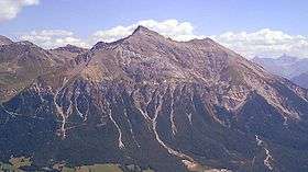
The Lenzerhorn (also spelled Lenzer Horn) is a mountain of the Plessur Alps, located east of Lenzerheide in the canton of Graubünden. It has an elevation of 2,906 metres and is, after the Aroser Rothorn, the second highest peak of the Plessur Alps.
References
External links
| Wikimedia Commons has media related to Lenzer Horn. |
This article is issued from
Wikipedia.
The text is licensed under Creative Commons - Attribution - Sharealike.
Additional terms may apply for the media files.