Lenton, Keisby and Osgodby
Lenton, Keisby and Osgodby is a civil parish in South Kesteven, Lincolnshire, England.[1] The population of the civil parish at the 2011 census was 187.[2] It is located along the river and in the valleys of the East Glen at its headwaters near Ingoldsby, where several minor streams join together.[3][4]
Geography
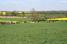
The highest land at the east and west is a small plateau of a Kellaways Sandstone laid down approximately 161 to 165 million years ago in the Jurassic Period. These lie some 80m above sea level. The East Glen valleys cut through this to a slightly older Blisworth Clay Mudstone layer, exposing thin layers on Kellaways clay and Cornbrash limestone on the way. The whole is overlaid with Quaternary glacial till from the recent Pleistocene. The lowest point in the parish is probably about 45m at the Ford in Osgodby, across the east Glen.
The streambeds of the Glen have their own associated alluvial linings of Sand And Gravel, Silt and Clay. [5][6][4]
The parish was home to a Second World War airfield at Folkingham,[7] which became a Cold War missile base.[8]
The parish is crossed by the route of the Roman road of King street.[4]
There are no major roads in the parish, and no railways.[4]
Constituent settlements

The main village is
and the hamlets of
- Osgodby (52°50′28″N 0°28′44″W / 52.841°N 0.479°W)
- Hanby (52°52′23″N 0°28′41″W / 52.873°N 0.478°W)
Other locations
- Little Lavington (52°52′01″N 0°28′16″W / 52.867°N 0.471°W)[9]
Former medieval village north of modern Lenton. The modern village of Lenton is sometimes called Lavington. - Osgodby (52°50′24″N 0°29′10″W / 52.840°N 0.486°W)[10]
Former medieval village near the old Manor and a few hundred metres west of the present hamlet - Hanby (52°50′24″N 0°29′10″W / 52.840°N 0.486°W)[11]
Former medieval village south-east of the present hamlet
References
- ↑ "Parish meeting details". SKDC. Retrieved 1 January 2013.
- ↑ "Civil parish population 2011". Neighbourhood Statistics. Office for National Statistics. Retrieved 19 May 2016.
- ↑ Grantham: Bottesford & Colsterworth (Map) (A1 ed.). 1:25000. Explorer. Ordnance Survey. 3 April 2006. p. 247. ISBN 9780319238332.
- 1 2 3 4 Bourne & Heckington: Billingborough & Morton (Map) (A1 ed.). 1:25000. Explorer. Ordnance Survey. 18 May 2012. p. 248. ISBN 9780319238110.
- ↑ Institute of Geological Sciences Geological Maps of England and Wales One-Inch Series Sheet 143 (1967)
- ↑ "BGS map of geological information". Retrieved 18 February 2016. - can be zoomed to show the villages
- ↑ Historic England. "Folkingham airfield (1395452)". PastScape. Retrieved 1 November 2013.
- ↑ Historic England. "Thor missile silo airfield (1156464)". PastScape. Retrieved 1 November 2013.
- ↑ Historic England (2007). "Little Lavington or Lenton (348765)". PastScape. Retrieved 10 April 2010.
- ↑ Historic England (2007). "Osgodby (348406)". PastScape. Retrieved 10 April 2010.
- ↑ Historic England (2007). "Monument No. 348773". PastScape. Retrieved 10 April 2010.
External links

- "All 34 historical records for the parish". Pastscape. English Heritage. Retrieved 10 April 2010.
England Portal | |
| Unitary authorities | |
| Boroughs or districts | |
| Major settlements |
|
| Topics | |