Leira, Trøndelag
| Leira | |
|---|---|
| Village | |
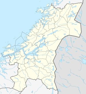
 Leira Location of the village  Leira Leira (Norway) | |
| Coordinates: 63°36′00″N 10°00′03″E / 63.6000°N 10.0007°ECoordinates: 63°36′00″N 10°00′03″E / 63.6000°N 10.0007°E | |
| Country | Norway |
| Region | Central Norway |
| County | Trøndelag |
| District | Fosen |
| Municipality | Indre Fosen |
| Elevation[1] | 11 m (36 ft) |
| Time zone | UTC+01:00 (CET) |
| • Summer (DST) | UTC+02:00 (CEST) |
| Post Code | 7100 Rissa |
Leira is a village in the municipality of Indre Fosen in Trøndelag county, Norway. It is located about 1.5 kilometres (0.93 mi) north of the village of Årnset, along the north shore of the lake Botn. It is about 7 kilometres (4.3 mi) west of the lake Storvatnet. Rissa Church is located on the south side of Leira.
Name
The name is derived from leire which means 'clay'. Leira is a common name of rivers many places in Norway.
References
- ↑ "Leira, Indre Fosen (Trøndelag)". yr.no. Retrieved 2018-03-05.
This article is issued from
Wikipedia.
The text is licensed under Creative Commons - Attribution - Sharealike.
Additional terms may apply for the media files.