Lein (Kocher)
| Lein | |
|---|---|
 | |
| Country | Germany |
| States | Baden-Württemberg |
| Physical characteristics | |
| River mouth |
Kocher 48°53′48″N 10°00′23″E / 48.8967°N 10.0064°ECoordinates: 48°53′48″N 10°00′23″E / 48.8967°N 10.0064°E |
| Length | 56.8 km (35.3 mi) [1] |
| Basin features | |
| Progression | Kocher→ Neckar→ Rhine→ North Sea |
| Basin size | 250 km2 (97 sq mi) [1] |
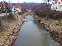
The Lein is a river of Baden-Württemberg, Germany. It is a left tributary of the Kocher.[2] Its source is near Kaisersbach. It passes through Welzheim, Täferrot, Leinzell and Heuchlingen, and flows into the Kocher in Abtsgmünd.
See also
References
| Wikimedia Commons has media related to Lein (Kocher). |
- 1 2 Map services of the Baden-Württemberg State Office for the Environment, Survey and Conservation (Landesanstalt für Umwelt, Messungen und Naturschutz Baden-Württemberg)
- ↑ Google (27 April 2018). "Lein" (Map). Google Maps. Google. Retrieved 27 April 2018.
This article is issued from
Wikipedia.
The text is licensed under Creative Commons - Attribution - Sharealike.
Additional terms may apply for the media files.