Lehndorf-Watenbüttel
| Lehndorf-Watenbüttel | |
|---|---|
| Stadtbezirk of Braunschweig | |
 Watenbüttel | |
 Lehndorf-Watenbüttel Location of Lehndorf-Watenbüttel within Braunschweig 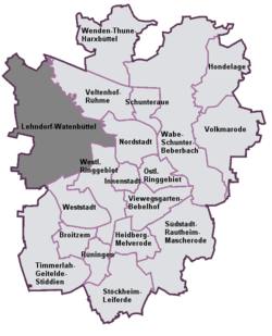 | |
| Coordinates: 52°17′0″N 10°27′44.9″E / 52.28333°N 10.462472°ECoordinates: 52°17′0″N 10°27′44.9″E / 52.28333°N 10.462472°E | |
| Country | Germany |
| State | Lower Saxony |
| District | Braunschweig urban district |
| City | Braunschweig |
| Government | |
| • Mayor | Frank Graffstedt (SPD) |
| Area | |
| • Total | 27.35 km2 (10.56 sq mi) |
| Population (2016-12-31) | |
| • Total | 21,791 |
| • Density | 800/km2 (2,100/sq mi) |
| Time zone | CET/CEST (UTC+1/+2) |
| Postal codes | 38112, 38114, 38116 |
| Dialling codes | 0531 |
| Vehicle registration | BS |
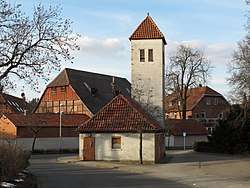
Lehndorf-Watenbüttel is a Stadtbezirk (city district) in the north-western part of Braunschweig, Germany. The Stadtbezirk comprises the quarters Kanzlerfeld, Lamme, Lehndorf, Ölper, Völkenrode, and Watenbüttel.[1]
History
The district consists of several villages that were incorporated into Braunschweig during the 20th century, in 1934 (Lehndorf and Ölper) and in 1974 (Lamme, Völkenrode, and Wattenbüttel),[2] as well as the Kanzlerfeld, a new quarter built in the 1960s.[3]
Politics
The district mayor Frank Graffstedt is a member of the Social Democratic Party of Germany.[4]
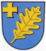
Coats of arms
 Coat of arms of Lamme
 Coat of arms of Lehndorf
 Coat of arms of Ölper
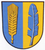 Coat of arms of Völkenrode
 Coat of arms of Watenbüttel
References
- ↑ Stadtbezirke (in German). Retrieved on 1 September 2017.
- ↑ "Kreisfreie Stadt Braunschweig" (PDF) (in German). statistik.niedersachsen.de.
- ↑ Kanzlerfeld - Trabantenstadt im Grünen (in German). Retrieved on 1 September 2017.
- ↑ Stadtbezirksrat im Stadtbezirk 321 Lehndorf-Watenbüttel (in German). Retrieved on 1 September 2017.
| Wikimedia Commons has media related to Lehndorf-Watenbüttel. |
|  | |
This article is issued from
Wikipedia.
The text is licensed under Creative Commons - Attribution - Sharealike.
Additional terms may apply for the media files.