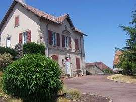
Le Rousset
| Le Rousset | |
|---|---|
 | |
 Le Rousset Location within Bourgogne-Franche-Comté region  Le Rousset | |
| Coordinates: 46°34′N 4°28′E / 46.57°N 4.47°ECoordinates: 46°34′N 4°28′E / 46.57°N 4.47°E | |
| Country | France |
| Region | Bourgogne-Franche-Comté |
| Department | Saône-et-Loire |
| Arrondissement | Charolles |
| Canton | La Guiche |
| Area1 | 24.74 km2 (9.55 sq mi) |
| Population (2006)2 | 265 |
| • Density | 11/km2 (28/sq mi) |
| Time zone | UTC+1 (CET) |
| • Summer (DST) | UTC+2 (CEST) |
| INSEE/Postal code | 71375 /71220 |
| Elevation |
265–486 m (869–1,594 ft) (avg. 433 m or 1,421 ft) |
|
1 French Land Register data, which excludes lakes, ponds, glaciers > 1 km2 (0.386 sq mi or 247 acres) and river estuaries. 2 Population without double counting: residents of multiple communes (e.g., students and military personnel) only counted once. | |
Le Rousset is a former commune in the Saône-et-Loire department in the region of Bourgogne-Franche-Comté in eastern France. On 1 January 2016, it was merged into the new commune of Le Rousset-Marizy.[1]
Geography
The Arconce flows southwest through the western part of the commune and forms part of its southwestern border.
See also
References
- ↑ Arrêté préfectoral 21 December 2015
| Wikimedia Commons has media related to Le Rousset. |
This article is issued from
Wikipedia.
The text is licensed under Creative Commons - Attribution - Sharealike.
Additional terms may apply for the media files.