Le Mesnil-Rainfray
| Le Mesnil-Rainfray | |
|---|---|
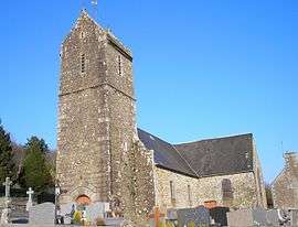 The church of Saint-Martin | |
 Le Mesnil-Rainfray Location within Normandy region  Le Mesnil-Rainfray | |
| Coordinates: 48°40′04″N 1°03′19″W / 48.6678°N 1.0553°WCoordinates: 48°40′04″N 1°03′19″W / 48.6678°N 1.0553°W | |
| Country | France |
| Region | Normandy |
| Department | Manche |
| Arrondissement | Avranches |
| Canton | Isigny-le-Buat |
| Area1 | 11.47 km2 (4.43 sq mi) |
| Population (2006)2 | 243 |
| • Density | 21/km2 (55/sq mi) |
| Time zone | UTC+1 (CET) |
| • Summer (DST) | UTC+2 (CEST) |
| INSEE/Postal code | 50318 /50520 |
| Elevation |
125–252 m (410–827 ft) (avg. 200 m or 660 ft) |
|
1 French Land Register data, which excludes lakes, ponds, glaciers > 1 km2 (0.386 sq mi or 247 acres) and river estuaries. 2 Population without double counting: residents of multiple communes (e.g., students and military personnel) only counted once. | |
Le Mesnil-Rainfray is a former commune in the Manche department in Normandy in north-western France. On 1 January 2017, it was merged into the new commune Juvigny les Vallées. This is an agricultural community, mainly dairy cattle, forage maze and cider apple production.[1]
See also
References
- ↑ Arrêté préfectoral 8 July 2016 (in French)
| Wikimedia Commons has media related to Le Mesnil-Rainfray. |
This article is issued from
Wikipedia.
The text is licensed under Creative Commons - Attribution - Sharealike.
Additional terms may apply for the media files.