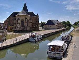
Le Chesne, Ardennes
| Le Chesne | ||
|---|---|---|
 | ||
| ||
 Le Chesne Location within Grand Est region  Le Chesne | ||
| Coordinates: 49°30′52″N 4°45′54″E / 49.5144°N 4.765°ECoordinates: 49°30′52″N 4°45′54″E / 49.5144°N 4.765°E | ||
| Country | France | |
| Region | Grand Est | |
| Department | Ardennes | |
| Arrondissement | Vouziers | |
| Intercommunality | Argonne Ardennaise | |
| Government | ||
| • Mayor (2008–2014) | Gérard Deglaire | |
| Area1 | 23.87 km2 (9.22 sq mi) | |
| Population (2008)2 | 981 | |
| • Density | 41/km2 (110/sq mi) | |
| Time zone | UTC+1 (CET) | |
| • Summer (DST) | UTC+2 (CEST) | |
| INSEE/Postal code | 08116 /08390 | |
| Elevation | 143–227 m (469–745 ft) | |
|
1 French Land Register data, which excludes lakes, ponds, glaciers > 1 km2 (0.386 sq mi or 247 acres) and river estuaries. 2 Population without double counting: residents of multiple communes (e.g., students and military personnel) only counted once. | ||

Le Chesne is a former commune in the Ardennes department in northern France. On 1 January 2016, it was merged into the new commune Bairon-et-ses-Environs.[1]
Population
| Historical population | ||
|---|---|---|
| Year | Pop. | ±% |
| 1962 | 1,078 | — |
| 1968 | 1,132 | +5.0% |
| 1975 | 1,047 | −7.5% |
| 1982 | 1,041 | −0.6% |
| 1990 | 974 | −6.4% |
| 1999 | 939 | −3.6% |
| 2008 | 981 | +4.5% |
See also
References
- ↑ Arrêté préfectoral 30 November 2015 (in French)
| Wikimedia Commons has media related to Le Chesne, Ardennes. |
This article is issued from
Wikipedia.
The text is licensed under Creative Commons - Attribution - Sharealike.
Additional terms may apply for the media files.