Le Chefresne
| Le Chefresne | ||
|---|---|---|
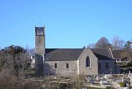 The church of Saint-Pierre | ||
| ||
 Le Chefresne Location within Normandy region  Le Chefresne | ||
| Coordinates: 48°54′14″N 1°09′11″W / 48.9039°N 1.1531°WCoordinates: 48°54′14″N 1°09′11″W / 48.9039°N 1.1531°W | ||
| Country | France | |
| Region | Normandy | |
| Department | Manche | |
| Arrondissement | Saint-Lô | |
| Canton | Villedieu-les-Poêles | |
| Government | ||
| • Mayor (2008–2014) | Jean-Claude Bossard | |
| Area1 | 11.28 km2 (4.36 sq mi) | |
| Population (2006)2 | 297 | |
| • Density | 26/km2 (68/sq mi) | |
| Demonym(s) | Chefresnais | |
| Time zone | UTC+1 (CET) | |
| • Summer (DST) | UTC+2 (CEST) | |
| INSEE/Postal code | 50128 /50410 | |
| Elevation |
115–228 m (377–748 ft) (avg. 250 m or 820 ft) | |
|
1 French Land Register data, which excludes lakes, ponds, glaciers > 1 km2 (0.386 sq mi or 247 acres) and river estuaries. 2 Population without double counting: residents of multiple communes (e.g., students and military personnel) only counted once. | ||
Le Chefresne is a former commune in the Manche department in Normandy in north-western France. On 1 January 2016, it was merged into the new commune of Percy-en-Normandie.[1]
Heraldry
.svg.png) |
The arms of Le Chefresne are blazoned : Per pale argent and azure, a ash vert and a huguenot cross Or, and on a chief gules a leopard Or armed and langued azure. |
See also
References
- ↑ Arrêté préfectoral 4 December 2015 (in French)
| Wikimedia Commons has media related to Le Chefresne. |
| Authority control |
|---|
This article is issued from
Wikipedia.
The text is licensed under Creative Commons - Attribution - Sharealike.
Additional terms may apply for the media files.