Le Chamossaire
| Le Chamossaire | |
|---|---|
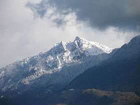 Le Chamossaire from the Rhone valley | |
| Highest point | |
| Elevation | 2,112 m (6,929 ft) |
| Prominence | 377 m (1,237 ft) [1] |
| Coordinates | 46°19′36″N 7°3′40.7″E / 46.32667°N 7.061306°ECoordinates: 46°19′36″N 7°3′40.7″E / 46.32667°N 7.061306°E |
| Geography | |
 Le Chamossaire Location in Switzerland | |
| Location | Vaud, Switzerland |
| Parent range | Bernese Alps |
Le Chamossaire is a mountain part of the Alpes Vaudoises, overlooking Villars-sur-Ollon on its south face and Les Ormonts valley on its north face. It is located in the canton of Vaud. The mountain is part of Villars ski area and its summit is easily accessible from Bretaye with the Bex–Villars–Bretaye railway and then a fast chairlift. Located more east is the Petit Chamossaire shoulder accessible via a brand new chairlift.
See also
References
- ↑ Retrieved from the Swisstopo topographic maps and Google Earth. The key col is located south of the Col de la Croix at 1,735 metres.
External links

- Le Chamossaire on Hikr
This article is issued from
Wikipedia.
The text is licensed under Creative Commons - Attribution - Sharealike.
Additional terms may apply for the media files.