Laukøya
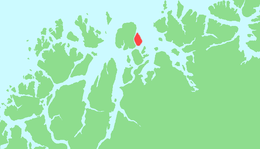 | |
 Laukøya Location of the island  Laukøya Laukøya (Norway) | |
| Geography | |
|---|---|
| Location | Troms, Norway |
| Coordinates | 70°06′22″N 20°50′30″E / 70.1061°N 20.8417°ECoordinates: 70°06′22″N 20°50′30″E / 70.1061°N 20.8417°E |
| Area | 35.8 km2 (13.8 sq mi) |
| Length | 10.2 km (6.34 mi) |
| Width | 5.5 km (3.42 mi) |
| Coastline | 25.2 km (15.66 mi) |
| Highest elevation | 821 m (2,694 ft) |
| Highest point | Langnestinden |
| Administration | |
|
Norway | |
| County | Troms |
| Municipality | Skjervøy Municipality |
Laukøya (Norwegian) or Unna Ártnás (Northern Sami) is an island in Skjervøy Municipality in Troms county, Norway. The island of Arnøya is immediately to the west of Laukøya, the Kvænangen fjord lies to the east, and the islands of Kågen and Skjervøya lie to the south. There is a regular ferry connection between Laukøya, Kågen, and Arnøya, but no road connections.[1]
See also
References
This article is issued from
Wikipedia.
The text is licensed under Creative Commons - Attribution - Sharealike.
Additional terms may apply for the media files.