Lathrop, Missouri
| Lathrop, Missouri | |
|---|---|
| City | |
| Nickname(s): The Mule Capital of the World | |
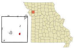 Location of Lathrop, Missouri | |
| Coordinates: 39°32′57″N 94°19′47″W / 39.54917°N 94.32972°WCoordinates: 39°32′57″N 94°19′47″W / 39.54917°N 94.32972°W | |
| Country | United States |
| State | Missouri |
| County | Clinton |
| Area[1] | |
| • Total | 1.79 sq mi (4.64 km2) |
| • Land | 1.79 sq mi (4.64 km2) |
| • Water | 0 sq mi (0 km2) |
| Elevation | 1,063 ft (324 m) |
| Population (2010)[2] | |
| • Total | 2,086 |
| • Estimate (2016)[3] | 2,046 |
| • Density | 1,200/sq mi (450/km2) |
| Time zone | UTC-6 (Central (CST)) |
| • Summer (DST) | UTC-5 (CDT) |
| ZIP code | 64465 |
| Area code(s) | 816 |
| FIPS code | 29-40826[4] |
| GNIS feature ID | 0720826[5] |
| Website | http://www.cityoflathropmo.com |
Lathrop is a city in Clinton County, Missouri, United States. The population was 2,086 at the 2010 census.
History
Lathrop was platted in 1867, and named in honor of a pioneer citizen.[6] A post office called Lathrop has been in operation since 1868.[7]
Geography
Lathrop is located at 39°32′57″N 94°19′47″W / 39.54917°N 94.32972°W (39.549153, -94.329747).[8]
According to the United States Census Bureau, the city has a total area of 1.79 square miles (4.64 km2), all land.[1]
Demographics
| Historical population | |||
|---|---|---|---|
| Census | Pop. | %± | |
| 1870 | 523 | — | |
| 1880 | 746 | 42.6% | |
| 1890 | 1,082 | 45.0% | |
| 1900 | 1,118 | 3.3% | |
| 1910 | 1,038 | −7.2% | |
| 1920 | 1,100 | 6.0% | |
| 1930 | 940 | −14.5% | |
| 1940 | 1,049 | 11.6% | |
| 1950 | 888 | −15.3% | |
| 1960 | 1,006 | 13.3% | |
| 1970 | 1,268 | 26.0% | |
| 1980 | 1,732 | 36.6% | |
| 1990 | 1,794 | 3.6% | |
| 2000 | 2,092 | 16.6% | |
| 2010 | 2,086 | −0.3% | |
| Est. 2016 | 2,046 | [3] | −1.9% |
| U.S. Decennial Census[9] | |||
2010 census
As of the census[2] of 2010, there were 2,086 people, 794 households, and 574 families residing in the city. The population density was 1,165.4 inhabitants per square mile (450.0/km2). There were 890 housing units at an average density of 497.2 per square mile (192.0/km2). The racial makeup of the city was 95.2% White, 1.2% African American, 1.2% Native American, 0.4% Asian, 0.3% from other races, and 1.7% from two or more races. Hispanic or Latino of any race were 1.2% of the population.
There were 794 households of which 40.1% had children under the age of 18 living with them, 52.0% were married couples living together, 14.7% had a female householder with no husband present, 5.5% had a male householder with no wife present, and 27.7% were non-families. 23.4% of all households were made up of individuals and 8.7% had someone living alone who was 65 years of age or older. The average household size was 2.63 and the average family size was 3.08.
The median age in the city was 34 years. 28.5% of residents were under the age of 18; 8.9% were between the ages of 18 and 24; 27.1% were from 25 to 44; 23.6% were from 45 to 64; and 11.7% were 65 years of age or older. The gender makeup of the city was 48.9% male and 51.1% female.
2000 census
As of the census[4] of 2000, there were 2,092 people, 766 households, and 557 families residing in the city. The population density was 1,508.5 people per square mile (581.1/km²). There were 827 housing units at an average density of 596.3 per square mile (229.7/km²). The racial makeup of the city was 96.27% White, 1.96% African American, 0.19% Native American, 0.05% Asian, 0.19% from other races, and 1.34% from two or more races. Hispanic or Latino of any race were 1.58% of the population.
There were 766 households out of which 41.5% had children under the age of 18 living with them, 55.4% were married couples living together, 13.6% had a female householder with no husband present, and 27.2% were non-families. 23.5% of all households were made up of individuals and 11.2% had someone living alone who was 65 years of age or older. The average household size was 2.66 and the average family size was 3.16.
In the city the population was spread out with 29.6% under the age of 18, 9.4% from 18 to 24, 29.5% from 25 to 44, 19.6% from 45 to 64, and 11.8% who were 65 years of age or older. The median age was 33 years. For every 100 females, there were 90.5 males. For every 100 females age 18 and over, there were 86.1 males.
The median income for a household in the city was $39,537, and the median income for a family was $46,157. Males had a median income of $34,286 versus $21,344 for females. The per capita income for the city was $17,189. About 8.9% of families and 10.9% of the population were below the poverty line, including 14.7% of those under age 18 and 12.6% of those age 65 or over.
References
- 1 2 "US Gazetteer files 2010". United States Census Bureau. Archived from the original on 2012-07-14. Retrieved 2012-07-08.
- 1 2 "American FactFinder". United States Census Bureau. Retrieved 2012-07-08.
- 1 2 "Population and Housing Unit Estimates". Retrieved June 9, 2017.
- 1 2 "American FactFinder". United States Census Bureau. Retrieved 2008-01-31.
- ↑ "US Board on Geographic Names". United States Geological Survey. 2007-10-25. Retrieved 2008-01-31.
- ↑ "Clinton County Place Names, 1928–1945 (archived)". The State Historical Society of Missouri. Archived from the original on 24 June 2016. Retrieved 21 September 2016.
- ↑ "Post Offices". Jim Forte Postal History. Retrieved 21 September 2016.
- ↑ "US Gazetteer files: 2010, 2000, and 1990". United States Census Bureau. 2011-02-12. Retrieved 2011-04-23.
- ↑ "Census of Population and Housing". Census.gov. Retrieved June 4, 2015.
External links
- Historic maps of Lathrop in the Sanborn Maps of Missouri Collection at the University of Missouri
Municipalities and communities of Clinton County, Missouri, United States | ||
|---|---|---|
| Cities | 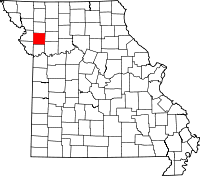 | |
| Village | ||
| Townships | ||
| Unincorporated communities | ||
| Footnotes | ‡This populated place also has portions in an adjacent county or counties | |