Last Chance Range (Nevada)
| Last Chance Range | |
|---|---|
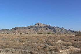 Seen from Pahrump to the south | |
| Highest point | |
| Elevation | 1,454 m (4,770 ft) |
| Geography | |
| Country | United States |
| State | Nevada |
| District | Nye County |
| Range coordinates | 36°18′59.850″N 116°5′23.111″W / 36.31662500°N 116.08975306°WCoordinates: 36°18′59.850″N 116°5′23.111″W / 36.31662500°N 116.08975306°W |
| Topo map | USGS Last Chance Range |

The Last Chance Range is a mountain range in Nye County, Nevada.[1] It lies immediately to the north of Pahrump, Nevada, and west of Nevada State Route 160.
References
- 1 2 "Last Chance Range". Geographic Names Information System. United States Geological Survey. Retrieved 2009-05-04.
This article is issued from
Wikipedia.
The text is licensed under Creative Commons - Attribution - Sharealike.
Additional terms may apply for the media files.